AT&T Hilliard L3I Underground Station
USA /
Ohio /
Hilliard /
World
/ USA
/ Ohio
/ Hilliard
abandoned / shut down, telecommunication, underground station, telephone switch, underground facility, underground station entrance / exit
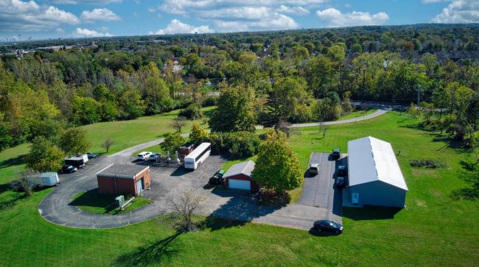
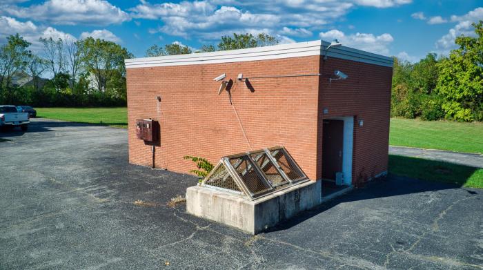
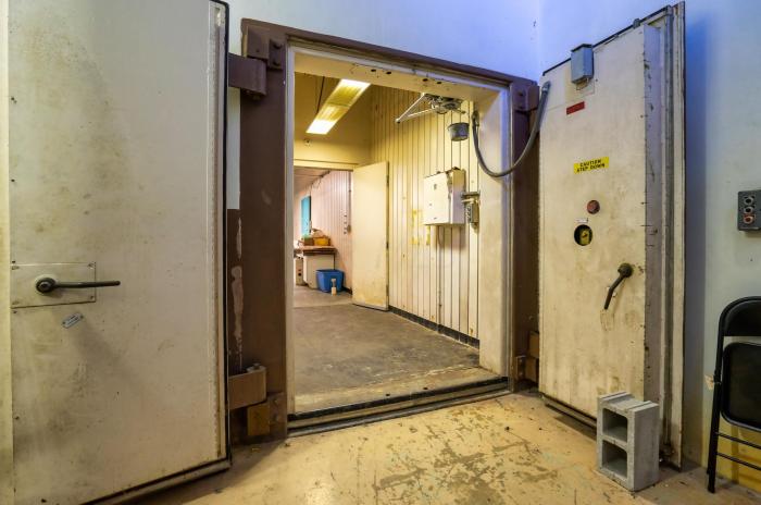


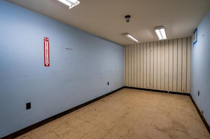
Former Long Lines Coaxial Cable Main Station
Underground Facility
Underground Facility
Nearby cities:
Coordinates: 40°3'19"N 83°9'55"W
- Cincinnati Subway (Abandoned) 156 km
- CFB North Bay NORAD Regional Sector Air Operations Centre (R/SAOC) 764 km
- Curtiss Wright Secret Underground Factory 773 km
- Shirley's Bay Research Centre 837 km
- Bayou Choctaw Strategic Petroleum Reserve 1312 km
- West Hackberry Strategic Petroleum Reserve (SRR) Site 1455 km
- Cheyenne Mountain Air Force Station 1867 km
- Waste Isolation Pilot Plant WIPP 2034 km
- Archuleta Mesa 2099 km
- Kárahnjúkar Hydropower Plant 5040 km
- Golf Club of Dublin 3.7 km
- Amity, Ohio 7.7 km
- Muirfield Village Golf Club 10 km
- Glacier Ridge Metro Park 10 km
- Plain City, Ohio 10 km
- Tartan Fields Golf Club 11 km
- New California Woods 13 km
- OShaughnessy Reservoir 16 km
- Madison County, Ohio 28 km
- Union County, Ohio 33 km