Culvert
United Kingdom /
England /
Milnthorpe /
Lancaster Canal Towpath
World
/ United Kingdom
/ England
/ Milnthorpe
culvert
Add category
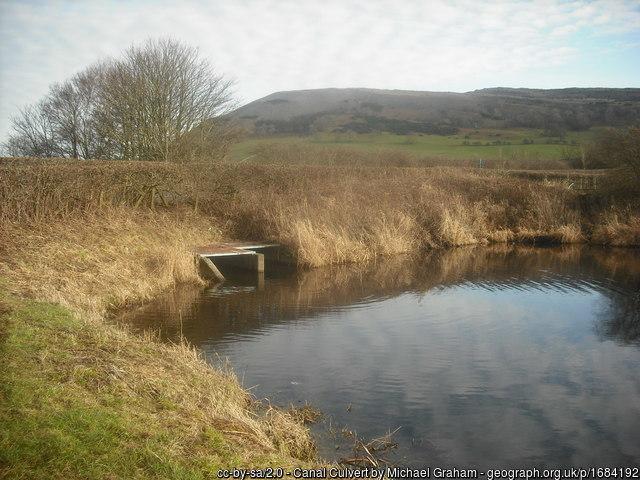
Carries the Lancaster Canal under North Road.
Photos:
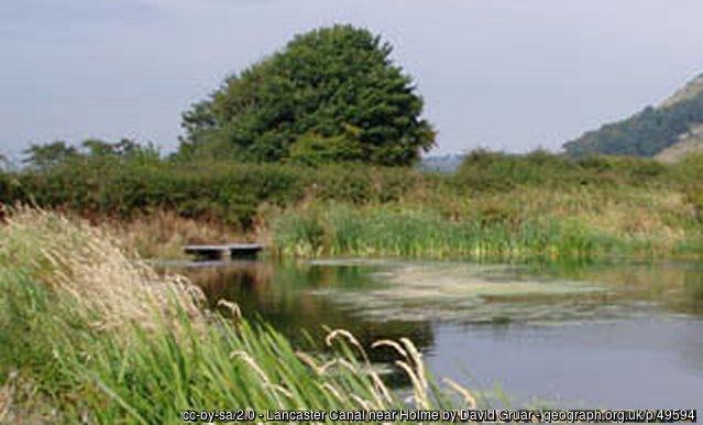
1) www.geograph.org.uk/photo/49594
2) www.geograph.org.uk/photo/1684192
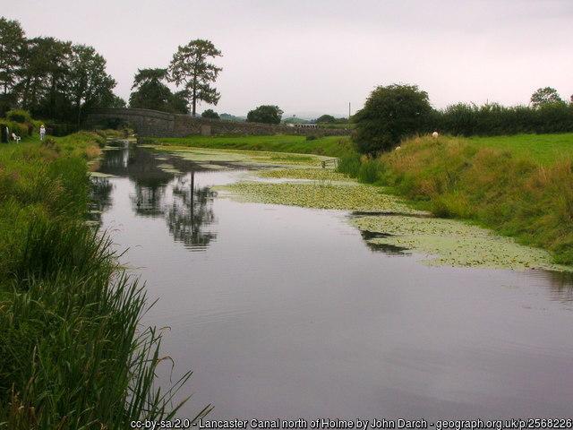
3) www.geograph.org.uk/photo/2568226 (as it appeared before being culverted).
Photos:
1) www.geograph.org.uk/photo/49594
2) www.geograph.org.uk/photo/1684192
3) www.geograph.org.uk/photo/2568226 (as it appeared before being culverted).
Wikipedia article: https://en.wikipedia.org/wiki/Lancaster_Canal
Nearby cities:
Coordinates: 54°12'40"N 2°43'34"W
- Culvert 4.6 km
- Culvert 87 km
- Culvert 122 km
- Pocklington Beck 131 km
- Trent Culvert under Queensway 139 km
- Culvert 163 km
- Culvert 171 km
- Culvert 256 km
- Slough Sewerage works water intake 332 km
- The Culvert 424 km
- Farleton Knott 1.7 km
- Leighton Moss 6.6 km
- Lyth Valley 10 km
- Cunswick Scar 12 km
- Gregareth 16 km
- Morecambe Bay 20 km
- Howgill Fells 24 km
- Garsdale 24 km
- Yorkshire Dales National Park 34 km
- Lake District National Park 37 km