Lyth Valley
United Kingdom /
England /
Milnthorpe /
A5074
World
/ United Kingdom
/ England
/ Milnthorpe
valley
Add category
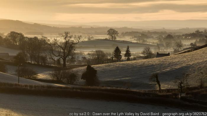
The flat bottom of the valley was originally bog, but it has been drained for the benefit of farmers. In recent years there has been controversy about the cost of the pumps which keep the valley drained. For some years the pumping has been funded by the Environment Agency, but after reviewing its priorities in the region the Agency decided it did not wish to continue. The creation of an Internal drainage board has been discussed. As at 2017, the pumps are still working pending a decision on how water level management is to be organised. -Wikipedia.
Photo: www.geograph.org.uk/photo/3820762
Photo: www.geograph.org.uk/photo/3820762
Wikipedia article: https://en.wikipedia.org/wiki/Lyth_Valley
Nearby cities:
Coordinates: 54°16'54"N 2°49'11"W
- Mach Loop 181 km
- Glens of Antrim (Glinntí Aontroma) 247 km
- Valle del Corneja 1539 km
- las Batuecas - Sierra de Francia Natural Park 1548 km
- Wad Draa 2757 km
- Wad Draa 2927 km
- Wad Draa 2936 km
- Uad Lemluia / Jeneig Ramla 3233 km
- Uad-ad-Dahab 3544 km
- Tenebrourette lost river 3902 km
- Whitbarrow Scar 1.8 km
- Great Tower Camp Site 8.3 km
- Cartmel CP 10 km
- Rusland Heights 11 km
- Windermere (lake) 11 km
- Belle Isle 12 km
- Claife Heights 13 km
- Esthwaite Water 14 km
- Kentmere Reservoir 15 km
- Lake District National Park 27 km