Maryland Heights
USA /
West Virginia /
Harpers Ferry /
World
/ USA
/ West Virginia
/ Harpers Ferry
World / United States / Maryland
park
Add category
Part of Harpers Ferry National Historic Park, which can be found on the internet here: www.nps.gov/archive/hafe/maps/maryland.htm
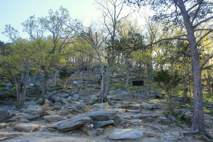
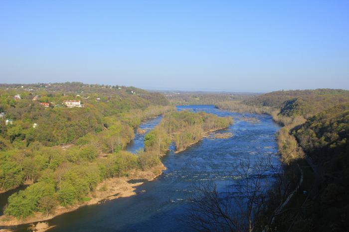
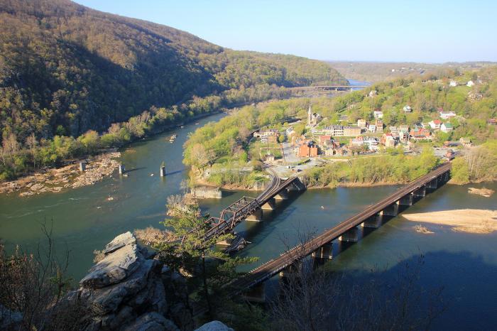
Moderately difficult trail leads to an excellent view of Harpers Ferry and the confluence of the Shenandoah and Potomac Rivers.
Description from LocalHikes.com:
"History combined with beauty! This is a hike over well-marked trails with many interpretive signs along the way. There are some steep climbs and some rocky terrain.
The first park of the hike features a spectacular overlook of Harpers Ferry and the Potomac and Shenandoah rivers. However, it doesn't come easily. The trail climbs steadily up a picturesque stream valley to a side trail leading to the overlook. The Overlook Trail descends for .5 mi, but is worth it! For a shorter hike (2.8), return the same way you came.
"The second part of the hike includes much history. The trail climbs to the ridge passing remains of fortifications built by the Union forces in 1862 after their defeat at Harpers Ferry. There are ammunition pits, breastworks, powder magizines, and gun batteries along the trail. The remains of the main fort are at the summit of Maryland Heights. A military camp was located in the level area just below the summit."
www.localhikes.com/Hikes/Maryland_Heights_8872.asp
www.hmdb.org/marker.asp?marker=5004
www.hmdb.org/marker.asp?marker=5034
www.hmdb.org/marker.asp?marker=5000
www.hmdb.org/marker.asp?marker=4982
Wikipedia article: http://en.wikipedia.org/wiki/Harpers_Ferry,_West_Virginia
Nearby cities:
Coordinates: 39°20'6"N 77°43'18"W
- Harpers Ferry National Historical Park 6.2 km
- Antietam National Battlefield 18 km
- South Mountain State Park 36 km
- Cunningham Falls State Park 39 km
- Catoctin Mountain Park 43 km
- G. Richard Thompson Wildlife Management Area 47 km
- Cacapon Resort State Park 62 km
- Raymond R. "Andy" Guest Jr. Shenandoah River State Park 74 km
- Green Ridge State Forest 83 km
- Buchanan State Forest 98 km
- Weverton, Maryland 2.1 km
- Loudoun Heights 3 km
- United States Customs and Border Protection Advanced Training Center 6.2 km
- Neersville, Virginia 6.9 km
- Boulevard at Potomac Towne Center 11 km
- Jefferson County, West Virginia 14 km
- Washington County, Maryland 27 km
- Loudoun County, Virginia 29 km
- Berkeley County, West Virginia 29 km
- Clarke County, Virginia 33 km