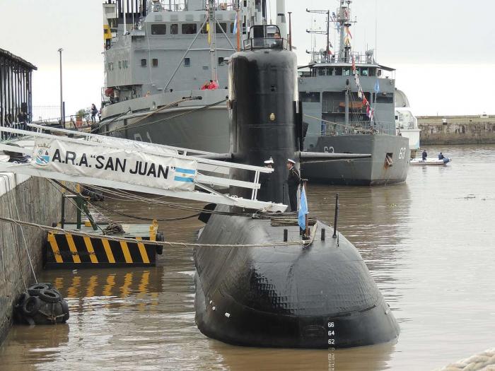
ARA San Juan submarine (Approximate)
Falkland Islands /
Port Howard /
World
/ Falkland Islands
/ Falkland Islands
/ Port Howard
shipwreck, submarine, sunken, mass grave
www.bbc.com/news/world-latin-america-46245686
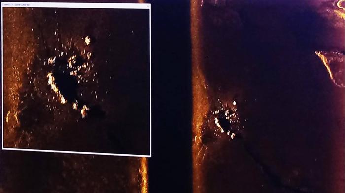
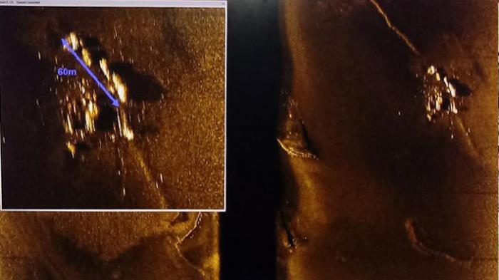
Found on November 16th at position PSN / LAT 44 ° 49.1' S / LONG. 059 ° 06.1'W
The ARA San Juan was returning from a routine mission to Ushuaia, near the southern tip of South America, when it reported an "electrical breakdown". According to naval commander Gabriel Galeazzi, the submarine surfaced and reported what was described as a "short circuit" in the vessel's batteries. The sub was ordered to cut its mission short and return to the naval base in Mar del Plata immediately.
The Argentine navy's last contact with the vessel was at approximately 07:30 (10:30 GMT) on 15 November, at which point its captain reportedly confirmed that the crew were well.
Spanish Language description of the submarine on Wikipedia
es.wikipedia.org/wiki/Desaparici%C3%B3n_del_ARA_San_Jua...
Wikipedia article: https://en.wikipedia.org/wiki/ARA_San_Juan_(S-42)
Nearby cities:
Coordinates: 46°26'16"S 60°4'44"W
- Wreck of SMS Scharnhorst 730 km
- Wreck of SMS Gneisenau 752 km
- Wreck of ARA General Belgrano 1002 km
- Approximate Sinking Location, HMS Good Hope 1550 km
- Approximate sinking location: HMS Monmouth 1559 km
- Wreck of USS La Moure County (LST-1194) 1940 km
- App. position of S/V CONCORDIA sinking 17.02.2010. 2701 km
- Wreck of USS St. Louis (CL-49) / NAe Tamandare (C-12) 4768 km
- approximate Sinking position of auxiliary cruiser Atlantis 6271 km
- Spacecraft cemetery 6326 km
Array