Glacier of Tears
Chile /
Libertador General Bernardo OHiggins /
Rengo /
World
/ Chile
/ Libertador General Bernardo OHiggins
/ Rengo
World / Argentina / Mendoza
valley, glacier, invisible
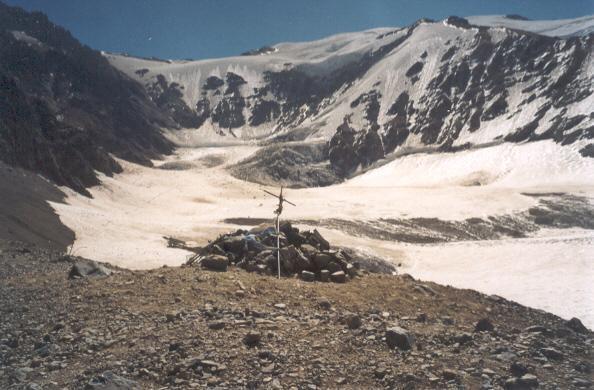
Lying just within Argentina, this glacier was where Uruguayan Air Force Fairchild 571 crashed in October 1972
Nearby cities:
Coordinates: 34°45'54"S 70°14'3"W
- Ice Fields Treaty 1623 km
- George VI Sound Ice Shelf 3908 km
- Wilkins Ice Shelf 3909 km
- Pine Island Glacier 4768 km
- Filchner-Ronne Ice Shelf 4898 km
- Thwaites Glacier 4914 km
- Korff Ice Rise 4916 km
- Smith Glacier 4993 km
- Slessor Glacier 5322 km
- Recovery Glacier 5416 km
- Avalanche Chute carrying tail section 2.7 km
- Impact site of Flight 571 4.2 km
- Impact somewhere on this ridge 5 km
- The Ascent to Heroe's Pass 7.6 km
- Construcciones volcan Overo 22 km
- Las Leñas Ski Resort 43 km
- Pozos de las Ánimas 52 km
- Potrerito de Los Morros Hill 3789 m 57 km
- Laguna La Niña Encantada (The Enchanted Girl Lagoon) 66 km
- "Laguna de Diamante" Provincial Park 90 km
Avalanche Chute carrying tail section
Impact site of Flight 571
Impact somewhere on this ridge
The Ascent to Heroe's Pass
Construcciones volcan Overo
Las Leñas Ski Resort
Pozos de las Ánimas
Potrerito de Los Morros Hill 3789 m
Laguna La Niña Encantada (The Enchanted Girl Lagoon)
"Laguna de Diamante" Provincial Park
Comments