San Quintin Volcanic Field
Mexico /
Baja California /
San Quintin /
World
/ Mexico
/ Baja California
/ San Quintin
cinder cone, volcanic plateau
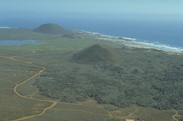
The San Quintín Volcanic Field is a collection of ten or eleven volcanic cinder cones situated along the Pacific coast of the Baja California peninsula in Mexico. The field formed by repeated eruptions beginning in the Pleistocene and ending about 3000 years ago.[1][2] It is one of several known Quaternary period volcanic fields in Baja. The lava shields appear to have first grown as subaqueous volcanoes that emerged as islands.[3]
Wikipedia article: http://en.wikipedia.org/wiki/San_Quintín_Volcanic_Field
Nearby cities:
Coordinates: 30°29'49"N 116°0'25"W
- Volcanoes & Cinder Cones 530 km
- Cinder Cones & Lava Beds 534 km
- Red Mountain 680 km
- Strawberry Crater Wilderness Area 696 km
- The Cinders 999 km
- China Hat 1535 km
- Tetherow Butte 1607 km
- Trout Creek Butte 1611 km
- Cinder Cones and Maar Craters 2253 km
- Chain of cinder cones 7791 km
- Pedregal 5.9 km
- San Quintin Bay 6.3 km
- Bahia Falsa (False Bay) 6.6 km
- Isla San Martin 10 km
- San Quintín Valley 12 km
- Rosario de Abajo 57 km
- Mountain San Miguel 62 km
- El Sauzalito 76 km
- Isla San Jerónimo 81 km
- Sierra de San Pedro Mártir National Park 84 km