Angkor (Siem Reap)
Cambodia /
Siem Reab /
Siem Reap
World
/ Cambodia
/ Siem Reab
/ Siem Reab
invisible, UNESCO World Heritage Site, listed building / architectural heritage
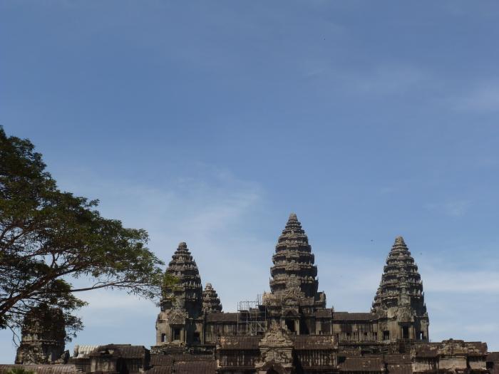
Angkor (Khmer: អង្គរ, "Capital City") was the capital city of the Khmer Empire, which flourished from approximately the 9th to 15th centuries. Angkor was a megacity supporting at least 0.1% of the global population during 1010-1220. The city houses the magnificent Angkor Wat.
Wikipedia article: https://en.wikipedia.org/wiki/Angkor
Nearby cities:
Coordinates: 13°26'55"N 103°52'31"E
- Manas National Park 2017 km
- Hubei Shennongjia 2122 km
- Cửu Trại Câu - JiuZhaiGou Valley National Park 2213 km
- Orkhon Valley - UNESCO World Heritage Site 3813 km
- Kyoto 4000 km
- Daursky State Nature Biosphere Reserve 4220 km
- Uvs Nuur 4278 km
- Sihote-Alinsky Nature Reserve 4668 km
- Lake Baikal 4719 km
- Lena Pillars National Park 5628 km
- Preah Khan 1.5 km
- Ta Prohm 2.2 km
- Jayatataka (Northern Baray) 2.6 km
- Moat around Angkor Wat 4.1 km
- Remnants of moat and walls of Yasodharapura 4.7 km
- Former Siem Reap-Angkor International Airport (Closed) 8 km
- West Baray 8.3 km
- Ancient Amarendrapura 12 km
- Puok 16 km
- Baray of Banteay Sra 18 km