Mason-Dixon Line Marker: Stone 58
USA /
Maryland /
Manchester /
World
/ USA
/ Maryland
/ Manchester
World / United States / Pennsylvania
border
Add category
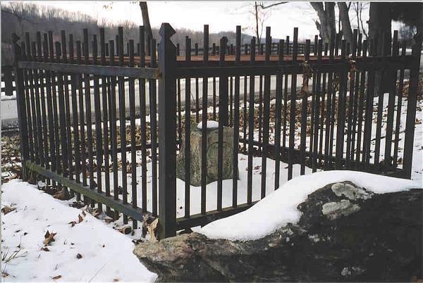
Mason-Dixon markers were placed along the Pennsylvania-Maryland border during the initial boundary survey. This marker is designated Stone 58 and is an example of a "crownstone": one that displays the Calvert coat of arms on the Maryland side of the stone and the Penn coat of arms on the Pennsylvania/Delaware side of the stone. Crownstones were placed every five miles.
Intermediate markers placed between crownstones do not display any coats of arms: they simply show an M on the Maryland side and a P on the Pennsylvania side.
This marker is protected from theft and vandalism by a metal cage, as you can see in the attached photograph.
Intermediate markers placed between crownstones do not display any coats of arms: they simply show an M on the Maryland side and a P on the Pennsylvania side.
This marker is protected from theft and vandalism by a metal cage, as you can see in the attached photograph.
Wikipedia article: http://en.wikipedia.org/wiki/Mason-Dixon_line
Nearby cities:
Coordinates: 39°43'14"N 76°49'25"W
- 12-Mile Circle 90 km
- former boundery wall 5891 km
- Moroccan Borderwall 5986 km
- Moroccan Western Sahara Wall 5988 km
- Moroccan Borderwall 6016 km
- former borderwall . 6033 km
- Moroccan borderwall 6122 km
- Moroccan borderwall 6126 km
- Moroccan borderwall 6132 km
- Wrangel Island 7634 km
- Codorus State Park 11 km
- Lake Marburg 11 km
- Parkville, Pennsylvania 14 km
- Pipe Creek Farm 15 km
- South Hills Golf Course 16 km
- Carroll County, Maryland 28 km
- York County, Pennsylvania 30 km
- Baltimore County, Maryland 38 km
- Adams County, Pennsylvania 39 km
- Mason Dixon Line 72 km