Highway of Death
Kuwait /
al-Jahra /
al-Wahhah /
World
/ Kuwait
/ al-Jahra
/ al-Wahhah
, 4 km from center (الواحة)
invisible, notable event
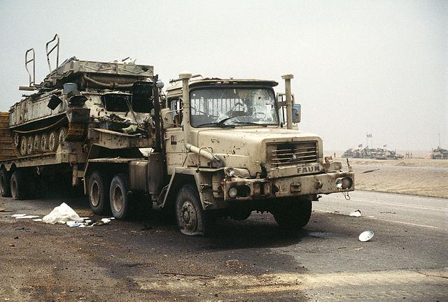
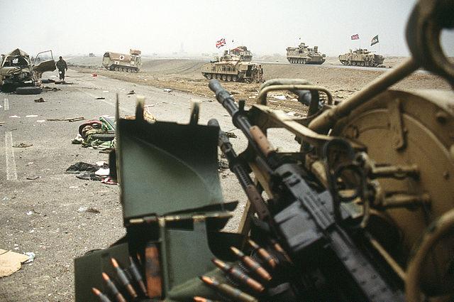

The Highway of Death (Arabic: طريق الموت ṭarīq al-mawt) refers to a six-lane highway between Kuwait and Iraq, officially known as Highway 80. It runs from Kuwait City to the border town of Safwan in Iraq and then on to the Iraqi city of Basra. The road had been used by Iraqi armored divisions for the 1990 Invasion of Kuwait. The road was repaired after the Persian Gulf War and used by U.S. and British forces in the initial stages of the 2003 invasion of Iraq.[3]
Wikipedia article: http://en.wikipedia.org/wiki/Highway_of_Death
Nearby cities:
Coordinates: 29°23'15"N 47°38'55"E
- Zardanashen, Artsakh 1147 km
- Karmir Shuka / Qirmizi Bazar 1148 km
- Chankatagh 1200 km
- Kusapat 1204 km
- Nerkin Horatagh 1206 km
- Air India Flight 855 - Crash site 2737 km
- Petlawad 2794 km
- epicenter of M6.4 quake on 2015-07-03 at 01:07:47 (UTC) 2955 km
- Central Ammunation Depot 3231 km
- LONG MARCH 5B ROCKET CRASHED LOCATION (02°65′ N - 72°47′ E) May 9, 2021 3958 km
- Camp Commando 2.2 km
- Shooting Range 3 km
- Shooting Range 5.7 km
- راس كاضمه 10 km
- مشروع مدينة المطلاع 12 km
- Radio Kuwait Umm Al-Ramim 14 km
- Ashairej Peninsula 17 km
- Sabah Al-Ahmad Natural Reserve 22 km
- Al-Asimah Governorate 26 km
- Gulf of Kuwait 28 km