Royal Park (Greater Melbourne, Victoria)
Australia /
Victoria /
Melbourne /
Greater Melbourne, Victoria
World
/ Australia
/ Victoria
/ Melbourne
World / Australia / Victoria
park, garden, dog park, green area
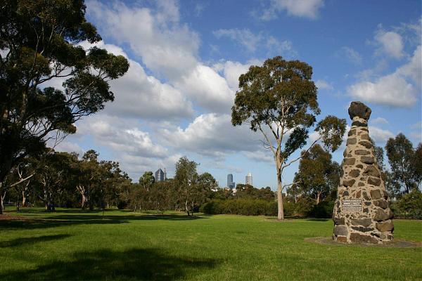
Royal Park is located in the suburb of Parkville. It is the largest of Melbourne's inner city parks at 181 hectares (446 acres).
Many sporting facilities are provided including the North Park Tennis Club, Royal Park Golf Course, football and soccer ovals, baseball and cricket pitches, State Netball and Hockey Centre, and cycling and walking paths. On the corner of Gatehouse street and Royal Parade there is a native garden. There are wide vistas of grassland and lightly timbered areas with eucalypts, casuarina and acacias. The Melbourne City Council administers the park and instituted in 1984 a park management plan. A wetlands area is being developed in 2005.
The grassy hill between the Royal Children's Hospital and the Native Garden is ideal for kite flying during the day. Over the summer months members of the Astronomical Society of Victoria set up telescopes and conduct evening talks and tours of the night sky from this vantage point.
Wikipedia article: http://en.wikipedia.org/wiki/Royal_Park,_Melbourne
Nearby cities:
Coordinates: 37°47'9"S 144°57'2"E
- Dog Beach St Kilda 8.3 km
- Ruffey Lake park 16 km
- Springbank Rise Dog Park 472 km
- Camperdown Memorial Rest Park 709 km
- Astrolabe Park 710 km
- North Wall Beach (designated off-leash area) 1124 km
- Horn Park 1315 km
- Kroll Gardens 1399 km
- Riverside Green Offleash Dog Park 2063 km
- AEROGLEN Touch Park - Off leash dog park 2327 km
- Parkville, Vic 0.1 km
- Brunswick 2.4 km
- Brunswick West 2.6 km
- Flemington, Vic 2.6 km
- Ascot Vale, Vic 3.1 km
- Coburg 4.7 km
- City of Yarra 5.1 km
- City of Merri-bek 5.7 km
- City of Moonee Valley 6.5 km
- City of Darebin 8.3 km
Comments