Figgate Park (Edinburgh)
United Kingdom /
Scotland /
Seafield /
Edinburgh
World
/ United Kingdom
/ Scotland
/ Seafield
park
Add category

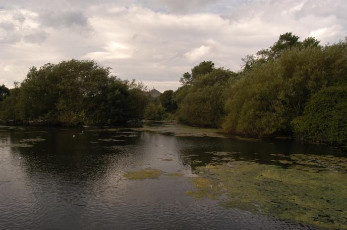
Follows a section of the Figgate Burn and includes flooded clay pit. Contains several ancient black poplars and ash trees.
Nearby cities:
Coordinates: 55°56'56"N 3°7'41"W
- Loch Leven 35 km
- Eden Estuary Nature Reserve 50 km
- Tentsmuir Forest 58 km
- Murthly Castle Designed Landscape 73 km
- Flanders Moss National Nature Reserve 79 km
- River Tay (Dunkeld) National Scenic Area 81 km
- Conerock Wood 175 km
- Glenn Brittle Forest 246 km
- Rumster Forest 269 km
- Borgie Forest 291 km
- Portobello 0.9 km
- South Leith 3.6 km
- Port o' Leith 4.7 km
- City of Edinburgh Council 10 km
- Midlothian Council 14 km
- Gladhouse Reservoir 20 km
- Dun Law Wind Farm 24 km
- East Lothian Council 25 km
- Toddleburn Wind Farm 26 km
- Scottish Borders 52 km