Dull
United Kingdom /
Scotland /
Aberfeldy /
B846
World
/ United Kingdom
/ Scotland
/ Aberfeldy
village
Add category
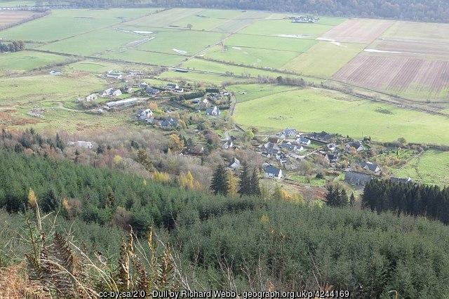
A single street of houses on the north side of the valley of the River Tay. The place-name may mean 'meadow' in Gaelic. -Wikipedia.
Photo: www.geograph.org.uk/photo/4244169
Photo: www.geograph.org.uk/photo/4244169
Wikipedia article: https://en.wikipedia.org/wiki/Dull,_Perth_and_Kinross
Nearby cities:
Coordinates: 56°37'6"N 3°56'32"W
- Bannockburn 58 km
- Lands of Bainsford 66 km
- Bonnybridge 68 km
- Dalgety Bay 72 km
- Caol 77 km
- Aberarder 81 km
- Bargeddie 84 km
- Chapelhall 85 km
- Midcalder 85 km
- Bridge Of Weir 93 km
- Griffin Forest 7.5 km
- Perth and Kinross Council 10 km
- Loch Tummel 11 km
- Griffin Wind Farm 14 km
- Loch Dhùn Alastair 15 km
- Loch Tay 16 km
- Loch Errochty 20 km
- River Tay (Dunkeld) National Scenic Area 22 km
- Loch Rannoch 24 km
- Aberdeenshire Council 98 km