Nineveh Plains
Iraq /
Ninawa /
Tall Kayf /
World
/ Iraq
/ Ninawa
/ Tall Kayf
, 17 km from center (تلكيف)
plain, invisible
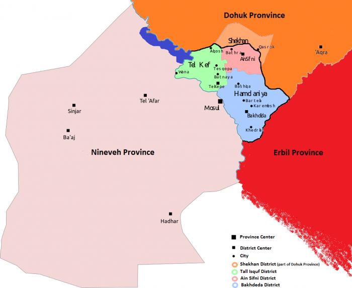
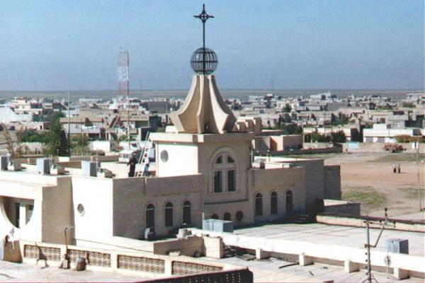
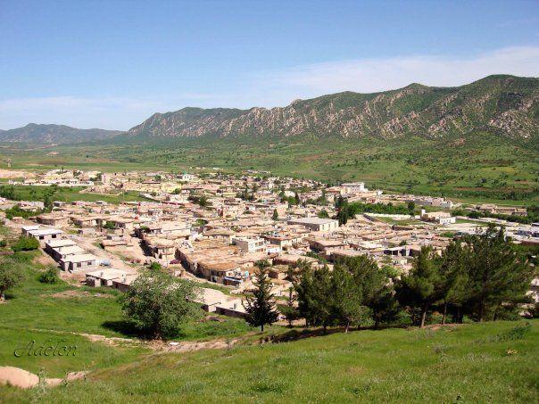


Nineveh plains (Classical Syriac: ܦܩܥܬܐ ܕܢܝܢܘܐ; Pqata d'Ninwĕ, Syriac: ܕܫܬܐ ܕܢܝܢܘܐ; Daŝta d'Ninwĕ, Arabic: سهل نينوى; sahl naynawā, Kurdish: Deşta Neynewa) is a region in the Ninawa Governorate of Iraq to the north and east of the city Mosul. It generally consists of three districts; Tel Keppe, Al-Hamdaniya, and Al-Shikhan. The area includes the ancient Assyrian ruins of the cities of Nineveh, Nimrud and Dur-Sharrukin, as well as numerous ancient religious sites such as Mar Mattai Monastery, Rabban Hormizd Monastery, Tomb of Nahum and Lalish.
This is the only spot in entire Iraq where the largest segment of the in habitants of Christians of various denominations following various traditions of the Syriac Christianity. The five patriarchal churches represented are:
Ancient Church of the East
Assyrian Church of the East
Chaldean Catholic Church
Syriac Catholic Church
Syriac Orthodox Church
The area is considered by its Assyrian inhabitants as being the original Assyrian heartland. Other inhabitants are the Yezidi-Kurds, Shabaki-Kurds, Turkmens and Muslim-Kurds.
The Assyrian inhabited towns and villages on the Nineveh Plain form a concentration of those belonging to Syriac Christian traditions, and since this area is the ancient home of the Assyrian empire through which the Assyrian people trace their cultural heritage, the Nineveh Plain is the area on which an effort to form an autonomous Assyrian entity has become concentrated. There have been calls by some politicians inside and outside Iraq into creating an autonomous region for Assyrian Christians in this area.
UN Report—In February 2010, The attacks against Assyrians in Mosul city forced 4,300 Assyrians to flea Mosul to the Nineveh plains where there is an Assyrian majority population.
2012 October-Present: The region is receiving many Iraqi-Assyrians from Syria since the violence has been escalating in Syria between pro-government and anti-government forces. Thousands of Assyrians are expected to migrate to the Nineveh Plains from Syria because of the conflict.
Nineveh Plain lies to the east, northeast of the city of Mosul in the Iraqi Ninawa Province. Although the actual ancient city of Nineveh is to be found in the eastern part of Mosul, on the bank of the Tigris river, the villages that are inhabited by minority religious groups that are non-Muslim lie to the east. Most of these inhabitants are Assyrian Christians. The Nineveh plains are not only the historical homeland of the Assyrian people and a crucible of pre-Arab and Kurd pre-Islamic Mesopotamian civilisation, but it is a province where a majority of the population is currently drawn from the minorities, around half of whom are Assyrians.
Autonomy
In the Transitional Administrative Law adopted in March 2004 in Baghdad, not only were provisions made for the preservation of Assyrian based culture through education and media, but a provision for an administrative unit also was accepted. Article 125 in Iraq's Constitution states that: "This Constitution shall guarantee the administrative, political, cultural, and educational rights of the various nationalities, such as Turkomen, Chaldeans, Assyrians, and all other constituents, and this shall be regulated by law." Since the towns and villages on the Nineveh Plain form a concentration of those belonging to Syriac Christian traditions, and since this area is the ancient home of the Assyrian empire through which these people trace their cultural heritage, the Nineveh Plain is the area on which the effort to form an autonomous Assyrian entity have become concentrated.
On January 21, 2014, the Iraqi government declared that Nineveh Plains would become a new province, which serves as a safe haven for Assyrians.
Following the war with ISIS and the huge influx of IDPs to Kurdistan Region, the north part of the Assyrian plain(down to Tall Isquf, Mount Bashiqa, Eski Kalak and the Grand Zab is protected by the Peshmerga, while the rest in under ISIS control. Peshmerga are traning an all assyrian brigade and assyrian liberation units.
Because of the sectarianism and violence this conflict brought to the Assyrians, it is seen that, when the Article 140 of the Iraqi Constitution and the Autonomy referenduns are voted, the Assyrian plains would become and Autonomous Region within Iraq, or, more probably, an Autonomous Region within Kurdistan Region of Iraq.
Ethno-Religious map of the Nienveh Plains: umap.openstreetmap.fr/pt/map/ethno-religious-compositio...
rudaw.net/english/kurdistan/070420151
en.wikipedia.org/wiki/Proposals_for_an_Assyrian_autonom...
www.assyrianamericancoalition.org/policy_open.php
Wikipedia article: http://en.wikipedia.org/wiki/Nineveh_plains
Nearby cities:
Coordinates: 36°23'31"N 43°16'6"E
- Kiziltepe plain 304 km
- Muş Valley 341 km
- Harran Plain 411 km
- Ararat valley 433 km
- Maskanah Plain 505 km
- Manbij-Birecik Plain 509 km
- Quweiq Plain 567 km
- Amik Plain 635 km
- Horan Plain 766 km
- Çukurova (Plain) 769 km
- PESHMARGA OP 2.6 km
- Bashik Subdistrict 3.9 km
- Mosque 5.2 km
- Tell Billa 5.2 km
- Military checkpoint 8.5 km
- Bashik Subdistrict (Baghdad) 10 km
- Mount Bashike 13 km
- Qaraqosh District 23 km
- قضاء شيخان 28 km
- Dohuk Province 43 km