Citadel
Syria /
Dayr-az-Zawr /
Dayr az-Zawr /
World
/ Syria
/ Dayr-az-Zawr
/ Dayr az-Zawr
, 46 km from center (دير الزور)
castle ruins, citadel
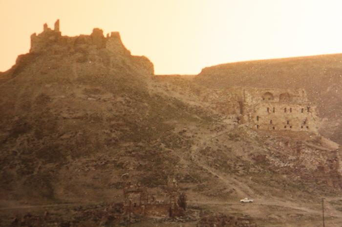

on the highest point of the fortification. Roof and floors were destroyed. The building was changed by Arab tribes that settled here later.
Nearby cities:
Coordinates: 35°41'22"N 39°49'6"E
- Diyarbakir/Amed Citadel 251 km
- "Saray-Berke" 1516 km
- Citadel of Alba Iulia (also known as Citadel Alba Carolina ) 1785 km
- Pechersk Citadel of Kyiv Fortress 1803 km
- Fortress of Arad 1937 km
- Fort Wall 4284 km
- Imperial Citadel 6421 km
- Co Loa citadel - Outer wall 6546 km
- Châu Sa citadel 7160 km
- The Citadel, The Military College of South Carolina 10166 km
- Khanuqa/Strangler gorge 1.2 km
- Daḩām mountain 2.3 km
- Al Kibar military facility base 2.7 km
- Kulayb Hammah plateau (376 m) 3.7 km
- Al Jazrah mountain 6.6 km
- Primitive oil wells and refinery 8 km
- Al-Tabni Subdistrict 11 km
- Hammat al-Jazirah 13 km
- Deir ez-Zor Civil Council (DFNS) 70 km
- Deir ez-Zor Governorate (PCS) 89 km