Spinney
United Kingdom /
England /
Woodbridge /
World
/ United Kingdom
/ England
/ Woodbridge
salt marsh
Add category
Source: OS via Where's the Path - wtp2.appspot.com/wheresthepath.htm?lat=52.034542&lon=1....
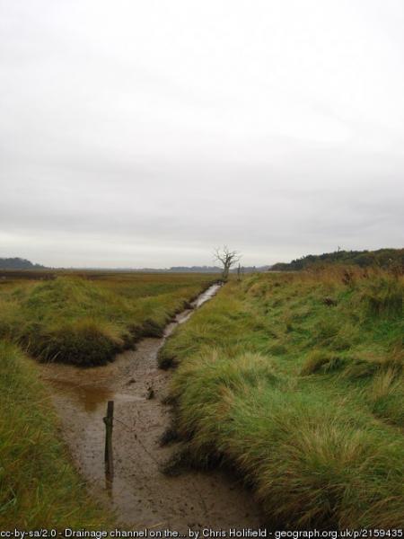
The salt marsh and intertidal mud-flats that occupy much of the Deben esuary have the widest range of salt marsh flora in Suffolk. -Adapted from Wikipedia.
Photo: www.geograph.org.uk/photo/2159435
The salt marsh and intertidal mud-flats that occupy much of the Deben esuary have the widest range of salt marsh flora in Suffolk. -Adapted from Wikipedia.
Photo: www.geograph.org.uk/photo/2159435
Wikipedia article: https://en.wikipedia.org/wiki/River_Deben
Nearby cities:
Coordinates: 52°2'19"N 1°20'25"E
- Shalkarteniz 4278 km
- Rud-e shurro River 4575 km
- Mazinan Playa 4607 km
- Jiriki Salt River 4641 km
- Godnamak 5119 km
- Chaleye Rud-e Shur 5139 km
- shurgaz- e hamun 5241 km
- Jamaica Bay Wildlife Refuge 5652 km
- Sri Koteshwar Rann 6378 km
- East Kolkata Wetlands 7862 km
- Newbourne Springs Nature Reserve 2.4 km
- Farmlands Housing Estate 6.6 km
- Levington Marina 6.7 km
- Rendlesham Forest 6.8 km
- Felixstowe Ferry Golf Club 6.9 km
- Suffolk Showground 7.7 km
- Orwell Park School 8.4 km
- Port of Felixstowe 10 km
- Harwich International Port Former Parkeston Quay 12 km
- Container Terminal Parkeston Quay & proposed Bathside Bay 12 km