Moira Lake
Canada /
Ontario /
Madoc /
World
/ Canada
/ Ontario
/ Madoc
World / Canada / Ontario / Hastings
lake
Add category
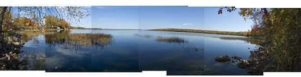

A recreational lake located in Hastings County, Ontario, Canada, fed by the Moira River. Bi-secting Highway 62 south of Madoc and Highway 7, it is rimmed with cottages along much of the shoreline and is a popular fishing destination. Trophy sized walleye (pickerel) and pike are caught annually, along with small mouth bass and perch and occasionally muskie (muskellunge).
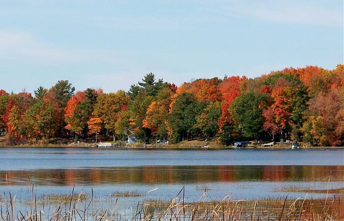
There is a public boat launch at Hwy 62 just south of the bridge that crosses the narrows between the east and west portion of the lake, and a trail that runs past the lake following an abandoned rail line. The larger east potion of the lake is dotted with five islands.
There is a public boat launch at Hwy 62 just south of the bridge that crosses the narrows between the east and west portion of the lake, and a trail that runs past the lake following an abandoned rail line. The larger east potion of the lake is dotted with five islands.
Wikipedia article: http://en.wikipedia.org/wiki/Moira_Lake
Nearby cities:
Coordinates: 44°29'11"N 77°27'15"W
- Big Gull Lake 53 km
- Mazinaw Lake 57 km
- Crotch Lake 71 km
- Rice Lake 74 km
- Buckhorn Lake 80 km
- Pigeon Lake 86 km
- Sturgeon Lake 104 km
- Charleston Lake 111 km
- Mississippi Lake 120 km
- Lake Ontario 189 km
- Canada Talc Industries. 1.7 km
- Municipality of Centre Hastings 8 km
- Township of Madoc 12 km
- Deloro Mine Site 13 km
- Township of Stirling-Rawdon 17 km
- Marmora Mines 17 km
- Riverside Pines 18 km
- Municipality of Tweed 19 km
- Municipality of Marmora and Lake 26 km
- Municipality of Trent Hills 37 km