Earhart Light
Kiribati /
Phoenix Islands /
Pyramid Point /
World
/ Kiribati
/ Phoenix Islands
/ Pyramid Point
World / United States Minor Outlying Islands
lighthouse, daymark / daybeacon, navigation beacon - marine
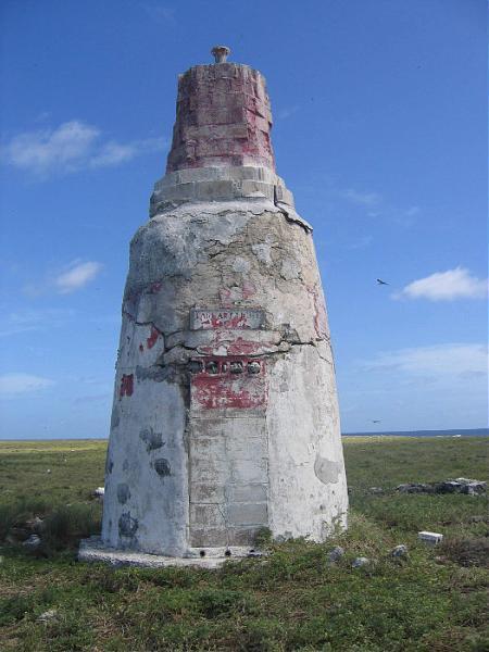
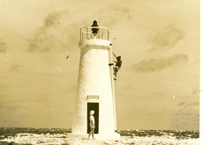
Earhart Light is a day beacon or navigational landmark shaped somewhat like a short lighthouse but without a light
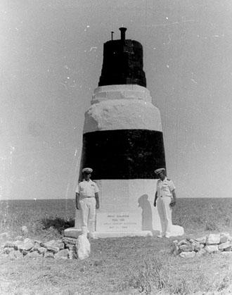
Earhart Light is named after Amelia Earhart, an American aviator.
The beacon was partially destroyed during early World War II by the Japanese attacks, but it was rebuilt in the early 1960s by men from the U.S. Coast Guard ship Blackhaw. By 2000, the beacon was reported to be crumbling and it had not been repainted in decades.
Wikipedia article: https://en.wikipedia.org/wiki/Howland_Island#Earhart_Light
Nearby cities:
Coordinates: 0°48'20"N 176°37'8"W
- Pahoa DGPS Station (Site 877) - US Coast Guard 3148 km
- United States Coast Guard, San Mateo Point 7131 km
- Sunken Harbor 7138 km
- Lantern Point 7138 km
- Regatta Rocks light 7274 km
- Vancouver / Fiddle Reef light 7347 km
- Clive Island 7354 km
- ALTAMIRA Entrance Beacon BS2 8828 km
- TUXPÁN N Breakwater Light 8876 km
- Pier at Puerto Angel 8936 km
- Itascatown Ruins 0.2 km
- Howland Island Small Boat Landing 0.2 km
- Howland Island 0.2 km
- Kamakaiwi Field (site) 0.4 km
- Guano Company Ruins 0.5 km
- Baker Island Daymark 70 km
- Radio Towers 70 km
- Baker Island 70 km
- Baker Island Airstrip (BAR) 70 km
- UD-4 Forward Section 340 km
Comments