Footpath Way Marker (Nuneaton)
United Kingdom /
England /
Nuneaton /
Public Footpath N61 (West of Eliot Park)
World
/ United Kingdom
/ England
/ Nuneaton
way mark
Add category
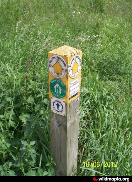
A footpath way marker situated by the public footpath along the west side of Eliot Park, and near to another public footpath of Centenary Way.
Nearby cities:
Coordinates: 52°30'27"N 1°28'48"W
- Bicknoller Post 193 km
- Six Hills 4063 km
- Jebel Kamil 4129 km
- Burj at Tuyur 4307 km
- Kapoorsar. 6108 km
- Anoop from jonaicha khurd to m..na khairal 6804 km
- Road to Garjia Temple 6847 km
- way to monkey point and sunset point 7327 km
- Way to Binodpur, Begusarai 7643 km
- Way to Kurangani 8374 km
- Eliot Park 0.2 km
- Hazell Way Industrial Estate 0.3 km
- Bermuda Park Residential Estate 0.3 km
- Bermuda Industrial Estate 0.6 km
- Green Space 0.8 km
- RS Components - Premises 0.9 km
- Bermuda Park 1 km
- Hill Top 1.1 km
- Wem Brook 1.1 km
- Arbury 2.3 km