Hill of Tara / Teamhair / Cnoc na Teamhrach
Ireland /
Meath /
Dunshaughlin /
World
/ Ireland
/ Meath
/ Dunshaughlin
World / Republic of Ireland
hill, archaeological site, interesting place
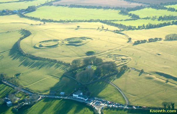
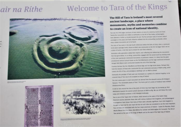
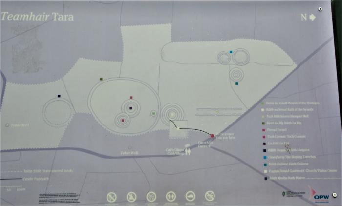
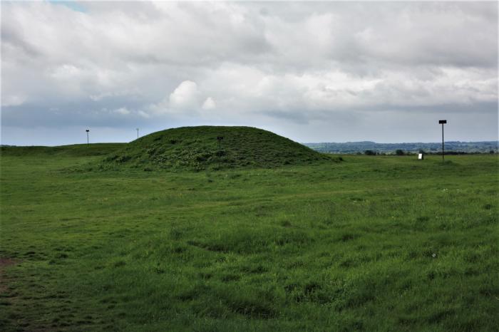
At the summit of the hill, to the north of the ridge, is an oval Iron Age hill fort, measuring 318m north-south by 264m east-west and enclosed by an internal ditch and external bank, known as Ráith na Rig (the Fort of the Kings, also known as the Royal Enclosure). The most prominent earthworks within are the two linked ringforts known as Teach Chormaic (Cormac's House) and the Forradh or Royal Seat. In the middle of the Forradh is a standing stone, which is believed to be the Lia Fáil (Stone of Destiny) at which the High Kings were crowned. According to legend, the stone would scream if a series of challenges were met by the would-be king. at his touch the stone would let out a screech that could be heard all over Ireland. To the north of the ringforts is a small neolithic passage tomb known as Dumha na nGiall (the Mound of the Hostages), which dates to ca. 2000 BC.
Wikipedia article: http://en.wikipedia.org/wiki/Hill_of_Tara
Nearby cities:
Coordinates: 53°34'44"N 6°36'42"W
- Dunsany Castle 4.7 km
- National Sports Campus 25 km
- boyne Sand flats 27 km
- Loughcrew (Loch Craobh) 40 km
- Bray Head Railway Line 55 km
- Carlingford (Cairlinn) (Kerling Fjorthr) 59 km
- The Great Heath of Maryborough 70 km
- Slieve Bloom Mountains (Sliabh Bladhma) 88 km
- Shannon-Erne Waterway / Uiscebhealach na Sionainne-na hÉirne 93 km
- Lough Key Forest Park 118 km
- Royal Tara Golf Club 2.9 km
- Killeen Castle 5 km
- M3 (Junc. 8) 6.3 km
- Moor Park Golf Club 6.3 km
- Johnstown 7 km
- Navan Business Park 7.6 km
- Johnstown Wood 7.8 km
- Athlumney Wood 8.3 km
- Knockharley Landfill Site 9 km
- County Meath (Contae na Mí) 13 km
Comments