Mithridat Mountain (Kerch)
Ukraine /
Krym /
Kerch
World
/ Ukraine
/ Krym
/ Kerch
, 1 km from center (Керч)
World / Ukraine / Crimea
mountain
Add category
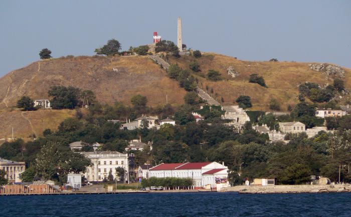
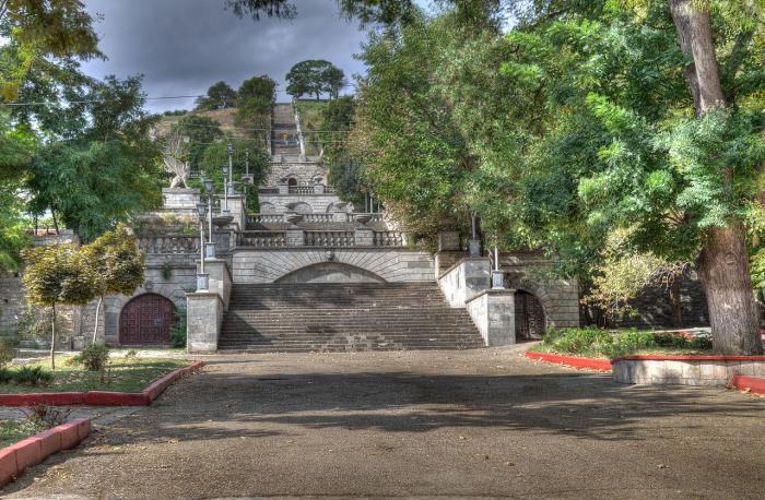
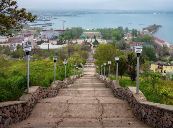
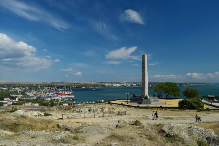
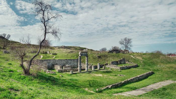
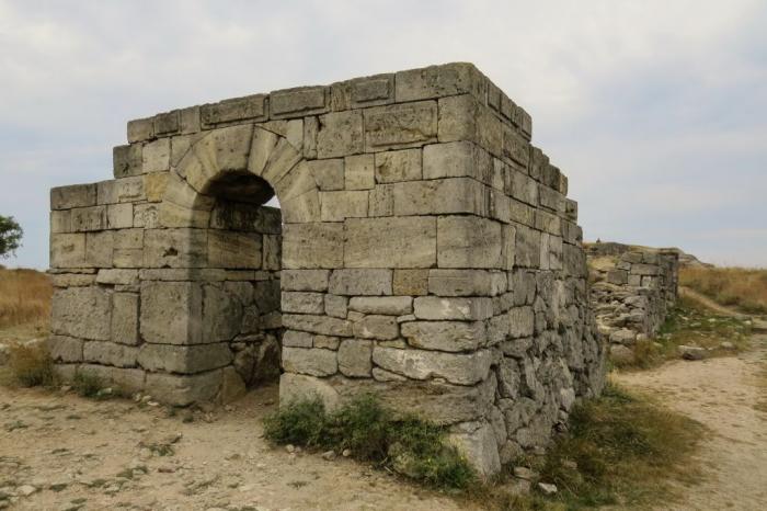
The central part of the ancient town, the acropolis, on the top of Mithridat Mountain. Panticapaeum was the name of the first settlement founded by the Greeks on the territory of modern Kerch in the 5th century BC. Later it became the permanent residence of the Bosporan Kings. Here, there was a strongly fortified palace belonging to the Spartokids. On the northern slope of the hill there was a trading square called "the agora". The town was decorated with the temples to Greek Gods and Goddesses, public buildings, and statues. Panticapaeum had a good harbour and a shipyard. Around the territory of Mithridat Mount there was a necropolis, Greek cemetery. Inside the Mount itself there were found many crypts, a number of which still bare the traces of ancient paintings. See the monumental Constantine Staircase from the top of Mount Mithridat. Greek city of Panticapeum was destroyed by the Huns in the 4th century.
Nearby cities:
Coordinates: 45°21'1"N 36°28'9"E
- Mud volcanoes 9 km
- Yuz-Oba ridge 12 km
- Ararat Mountain 14 km
- Chyorniy Khrebet Stow 16 km
- Tashkalak mountain 17 km
- Bishulianska mountain 25 km
- Dlinnaya mountain 30 km
- Korsak-Mohyla Mountain 175 km
- Rakyt Ridge 373 km
- Karachun Hill 395 km
- Panticapaeum columns 0.1 km
- Panticapaeum 0.1 km
- ulitsa Chelova / vulytsia Chelova, 1 0.2 km
- ulitsa Chelova / vulytsia Chelova, 22 0.3 km
- Radiostation 0.3 km
- Dugout/Bunker 0.3 km
- Old Kerch cemetery 0.4 km
- Pervaya Esplanadnaya ulitsa / vulytsia Persha Esplanadna, 29 0.4 km
- Pervy Pugachyovsky pereulok / Pershyi Puhachovskyi provulok, 3 0.4 km
- Kerch Strait 13 km