Famagusta District
Cyprus /
Government controlled area /
Acheritou /
World
/ Cyprus
/ Government controlled area
/ Acheritou
World / Cyprus
district, invisible, draw only border
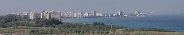
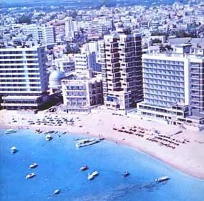

Famagusta District is one of the six districts of Cyprus. Its main town is the island's most important port, Famagusta. The vast majority of the district is currently controlled by the Turkish Republic of Northern Cyprus which is not recognized internationally. See Cyprus dispute.
A district administration in "exile" exists on the Republic of Cyprus controlled part of the island. This part of the district has a population of 37,738 inhabitants (2001).
A district administration in "exile" exists on the Republic of Cyprus controlled part of the island. This part of the district has a population of 37,738 inhabitants (2001).
Wikipedia article: http://en.wikipedia.org/wiki/Famagusta_District
Nearby cities:
Coordinates: 35°11'8"N 33°49'14"E
- Batroun District 192 km
- Akkar District 202 km
- Minyeh Ed-Denniyeh District 203 km
- Talkalakh district 212 km
- Shouf District 214 km
- Western Bekaa District 230 km
- Antakya district 241 km
- Markaz Hama Subdistrict 244 km
- Al-Bab District (PCS) 343 km
- Girê Spî/Tell Abyad Area (DFNS) 464 km
- Royal Tombs 6.4 km
- Pigi 7.2 km
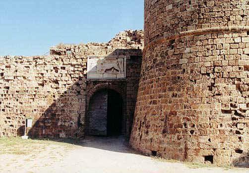
- Salamis 7.5 km
- Noyanlar site 17 - Royal Sun Residence 10 km
- Geçitkale Airport 10 km
- Mesaoria Plain 11 km
- Merit Cyprus Gardens Hotel 14 km
- Famagusta Bay 16 km
- Beşparmak Mountains 29 km
- Karpaz Peninsula 50 km