Tata Sabaya Volcano
| mountain
Bolivia /
Oruro /
Santiago de Huari /
World
/ Bolivia
/ Oruro
/ Santiago de Huari
World / Bolivia / Oruro / Atahuallpa
mountain, volcano
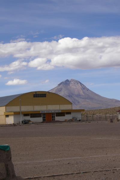
Tata Sabaya is a stratovolcano in Bolivia. It is located at the northern end of the Salar de Coipasa, which lies in the Altiplano. Its last eruption date is unknown, but it is assigned to the Holocene due to the youthful appearance of the mountain. Tata Sabaya consists of three separate features. At the base lies a pyroclastic shield, topped by lava domes, and finally by a stratovolcano. One of the most spectacular events in the volcano's past was a debris avalanche which covered 300 km² to the south of the mountain. Subsequent eruptions have rebuilt the peak to its current appearance. Particularly recent lava flows lie on the western and north-western flanks of the volcano, and the partial collapse of the summit dome has produced deposits on the south-western flank.
Elevation: 5,430 metres (17,815 ft)
Type: Stratovolcano
Elevation: 5,430 metres (17,815 ft)
Type: Stratovolcano
Wikipedia article: http://en.wikipedia.org/wiki/Tata_Sabaya
Nearby cities:
Coordinates: 19°8'7"S 68°31'27"W
- Caldera Mamuta 100 km
- Tunupa Volcano 111 km
- Volcan Nevado Sajama 124 km
- Salar de Huasco 131 km
- Volcan Nevado Anallajsi 144 km
- Caltama mountain 169 km
- Volcan Ollagüe 241 km
- Illimani 291 km
- Tutupaca volcano 307 km
- Ticsani Volcano 5408 m 349 km
- Pukara Loma (Bolivia) 15 km
- Pampa Uquichicara (Chili) 27 km
- ancient canal 30 km
- Pampa Encuelca 32 km
- Salar de Coipasa, 3657 m. 61 km
- lines 75 km
- Ruins in the Geoglyph Radiant Point 77 km
- intersection of lines 82 km
- ancient canal crosses ancient dam 93 km
- Anto Kkota lagoon 120 km