Chalan Beel of Natore Area
Bangladesh /
Nator /
World
/ Bangladesh
/ Nator
/ Nator
World / Bangladesh / Rajshahi / Rajshahi / Natore
water, balancing lake / flood basin
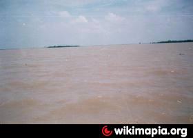

Chalan Beel (Bengali: চলনবিল) is a wetland in Bangladesh. It is a large inland depression, marshy in character, with rich flora and fauna. Forty-seven rivers and other waterways flow into the Chalan Beel. As silt builds up in the beel, its size is being reduced.
Chalan Beel is an extensive lowland area in the lower Atrai basin, and spreads across Singra and Gurudaspur upazilas on Natore District, Chatmohar, Bhanga and Faridpur upazilas of Pabna District, and Ullahpara, Raiganj and Tarash upazilas of Sirajganj District. It consists of a series of beels connected to one another by various channels to form a continuous water body during the rainy season. Although the beel area expands into a vast water body with dense aquatic vegetation as long as the Jamuna remains flooded during the monsoon months, it dries out in the winter months, leaving only patches of water in the central parts of this zone.
Chalan Beel is fast silting up. In the past it covered an area of about 1,085 km² but was reduced to 368 km² in 1909, of which only 85 km² remained underwater throughout the year. It has since shrunk to only 26 km².
The most important factor dominating the river history in Bengal is the large proportion of silt carried by its rivers. It is the silt which has created the land and made it habitable by building it up through the centuries. It is silt which is fertilising the land, but the silt, which has been the most beneficial gift of nature, has also produced most of the river problems now confronting the people of Bengal. Silt deposited in the old river channel beds has forced them to change course, creating problems for abandoned areas while assisting in developing new areas.
The main volume of water from the Ganges River began flowing through the Padma channel in the sixteenth century. Silt from the Padma helped in building up the southern portion of north Bengal. This is the most plausible explanation for the existence of a depression around Chalan Beel. The Teesta was active in the region until it changed its course in 1787. This territory lies in between the land raised in the north by the Teesta system when it was active and that in the south by the Padma.
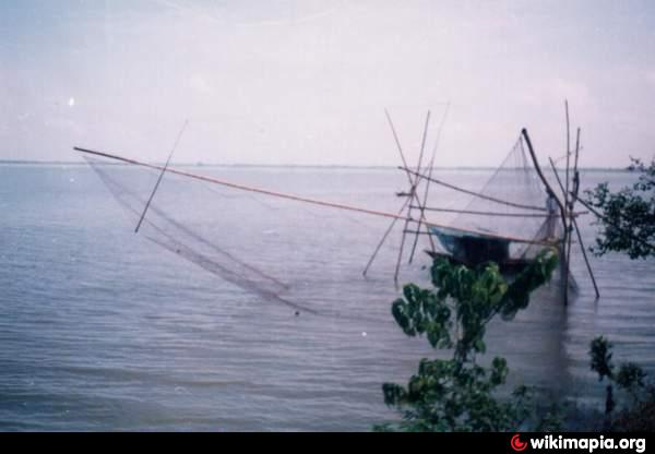
The banks of the beel are covered with dense stands of kash , babla, nol, dhol kolmi, simul, and date palm. Seven species of frogs and one species of toad represent the amphibian fauna. Chalan Beel has a total of 34 species of reptiles include ten turtles and tortoises, nine lizards and various snake species. There are 27 species of mammals from 12 families.
Chalan Beel is an extensive lowland area in the lower Atrai basin, and spreads across Singra and Gurudaspur upazilas on Natore District, Chatmohar, Bhanga and Faridpur upazilas of Pabna District, and Ullahpara, Raiganj and Tarash upazilas of Sirajganj District. It consists of a series of beels connected to one another by various channels to form a continuous water body during the rainy season. Although the beel area expands into a vast water body with dense aquatic vegetation as long as the Jamuna remains flooded during the monsoon months, it dries out in the winter months, leaving only patches of water in the central parts of this zone.
Chalan Beel is fast silting up. In the past it covered an area of about 1,085 km² but was reduced to 368 km² in 1909, of which only 85 km² remained underwater throughout the year. It has since shrunk to only 26 km².
The most important factor dominating the river history in Bengal is the large proportion of silt carried by its rivers. It is the silt which has created the land and made it habitable by building it up through the centuries. It is silt which is fertilising the land, but the silt, which has been the most beneficial gift of nature, has also produced most of the river problems now confronting the people of Bengal. Silt deposited in the old river channel beds has forced them to change course, creating problems for abandoned areas while assisting in developing new areas.
The main volume of water from the Ganges River began flowing through the Padma channel in the sixteenth century. Silt from the Padma helped in building up the southern portion of north Bengal. This is the most plausible explanation for the existence of a depression around Chalan Beel. The Teesta was active in the region until it changed its course in 1787. This territory lies in between the land raised in the north by the Teesta system when it was active and that in the south by the Padma.
The banks of the beel are covered with dense stands of kash , babla, nol, dhol kolmi, simul, and date palm. Seven species of frogs and one species of toad represent the amphibian fauna. Chalan Beel has a total of 34 species of reptiles include ten turtles and tortoises, nine lizards and various snake species. There are 27 species of mammals from 12 families.
Wikipedia article: http://en.wikipedia.org/wiki/Chalan_Beel
Nearby cities:
Coordinates: 24°31'0"N 89°0'37"E
- Bura Beel , ALTAPUR 169 km
- Nidhi Panda Railway bridge. 390 km
- Yamuna Flood Plains & Agricultural Area, Mayur Vihar 1254 km
- mattampalle balancing reservoir 1281 km
- Ghatleshwar Talab 1318 km
- Alaganoor Reservoir 1479 km
- Thanigaipolur Lake 1604 km
- Thanigai Polur Thangal 1605 km
- Garudanahalli Lake 1708 km
- kalinaikkanur Kuttai 1872 km
- ANCHRAKHALI--BHUSHANGACHHA 3.3 km
- Sherkole 8.9 km
- NORTH BORGACHA (ANWAR) 12 km
- bhatkuja 26 km
- Baraigram Upazila HQ 26 km
- Dhanaidaha 34 km
- Lalpur Upazila HQ 35 km
- Jonael,Haripur 37 km
- Chatmohar Upazila 42 km
- Rajshahi Division 78 km
Comments