Clay Wade Bailey Bridge
USA /
Kentucky /
Park Hills /
World
/ USA
/ Kentucky
/ Park Hills
World / United States / Kentucky
road bridge, cantilever bridge
www.cincinnati-transit.net/claywade.html
maps.live.com/default.aspx?v=2&cp=39.092713~-84.519541&...
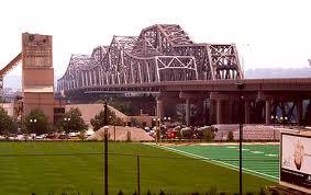
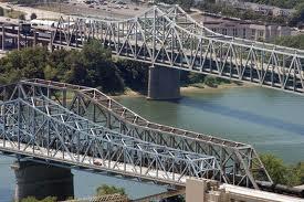
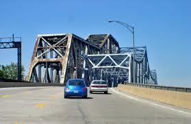
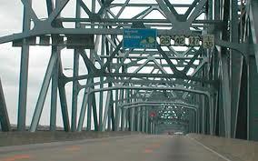
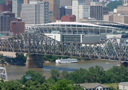
The C&O (1929) and Clay Wade Bailey Bridges stand immediately next to one another (pictured above), and share two piers in the middle of the river. Today's Clay Wade Bailey Bridge opened in 1974 along the alignment of the original C&O Bridge (1889), and still uses one of its original main span piers. It has a 675ft. main span identical to the adjacent "new" C&O. The previously shared 1889/1929 southern pier was reused and the 2nd C&O's northern pier was extended west, creating a 1929/1974 shared pier. The old C&O's northern main span pier was dismantled, allowing a clear 675ft. navigation channel beneath. As determined by the re-use of the 1889/29 pier, the deck was wide enough for three but not four lanes, resulting in a center variable-direction lane. The bridge was named after Clay Wade Bailey, a prominant Kentucky newspaper reporter.
maps.live.com/default.aspx?v=2&cp=39.092713~-84.519541&...
The C&O (1929) and Clay Wade Bailey Bridges stand immediately next to one another (pictured above), and share two piers in the middle of the river. Today's Clay Wade Bailey Bridge opened in 1974 along the alignment of the original C&O Bridge (1889), and still uses one of its original main span piers. It has a 675ft. main span identical to the adjacent "new" C&O. The previously shared 1889/1929 southern pier was reused and the 2nd C&O's northern pier was extended west, creating a 1929/1974 shared pier. The old C&O's northern main span pier was dismantled, allowing a clear 675ft. navigation channel beneath. As determined by the re-use of the 1889/29 pier, the deck was wide enough for three but not four lanes, resulting in a center variable-direction lane. The bridge was named after Clay Wade Bailey, a prominant Kentucky newspaper reporter.
Wikipedia article: http://en.wikipedia.org/wiki/Clay_Wade_Bailey_Bridge
Nearby cities:
Coordinates: 39°5'28"N 84°31'9"W
- George Rogers Clark Memorial Bridge (US-31) 141 km
- Sherman Minton Bridge 145 km
- Matthew Welch Bridge 189 km
- Bob Cummings - Lincoln Trail Bridge 235 km
- William H. Natcher Bridge 256 km
- Irvin S. Cobb Bridge 422 km
- Interstate 24 Bridge 425 km
- Cairo Ohio River Bridge 468 km
- Cairo Mississippi River Bridge 469 km
- Chester Bridge 482 km
- Kenton Hills 2.2 km
- Devou Park 2.2 km
- Peaselburg 3 km
- West Latonia 4.9 km
- Latonia Rosedale 5.9 km
- South Covington 7 km
- Hamilton County, Ohio 8.5 km
- DeCoursey Railroad Yards 10 km
- Kenton County, Kentucky 16 km
- Campbell County, Kentucky 19 km