Kish Bank Lighthouse
Ireland /
Wicklow /
Bray /
World
/ Ireland
/ Wicklow
/ Bray
World / Republic of Ireland
lighthouse, shoal, sandbar, foghorn, helicopter landing pad

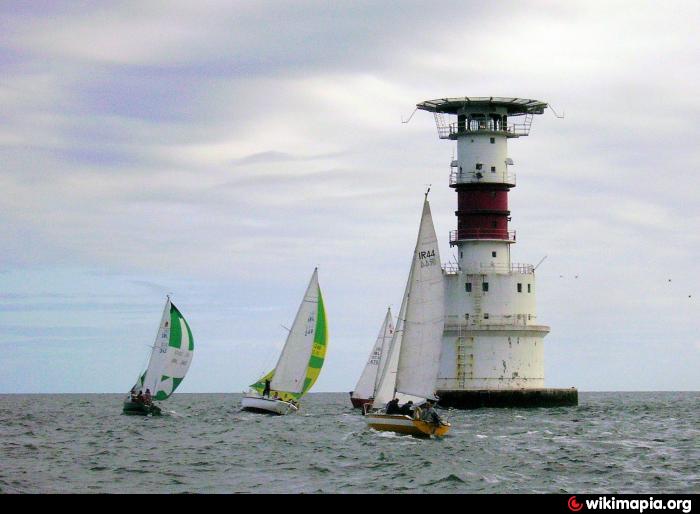

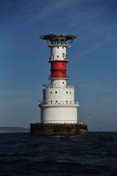
Shallow sandbar about 10km from Dublin Harbour. It is marked by a well-known lighthouse.
Naturally many shipwrecks are in the area, which makes it a popular diving spot. Four miles east of the lighthouse, on 10 October 1918, RMS Leinster was torpedoed and sunk by a German submarine with over 500 lives lost, the greatest single loss of life on the Irish Sea.
The bar was first marked by a lightship in 1811. The current lighthouse was activated in 1965 and automated in 1992.
Wikipedia article: http://en.wikipedia.org/wiki/Kish_Bank
Nearby cities:
Coordinates: 53°18'39"N 5°55'33"W
- Black Rock Lighthouse 209 km
- Carntullagh Head / Ceann Carn Tulach 220 km
- Mull Of Kintyre Lighthouse 223 km
- Lighthouse Dunree 235 km
- Scattery Island Lighthouse 253 km
- Corlis Point Front Leading Light 259 km
- Lighthouse 274 km
- Loop Head Lighthouse 281 km
- broadhaven´s lighthouse 282 km
- Blacksod Lighthouse 286 km
- R.M.S Leinster 8.7 km