Mount Berit
| summit
Turkey /
Kahramanmaras /
Afsin /
World
/ Turkey
/ Kahramanmaras
/ Afsin
World / Turkey / K. Maras
summit, draw only border
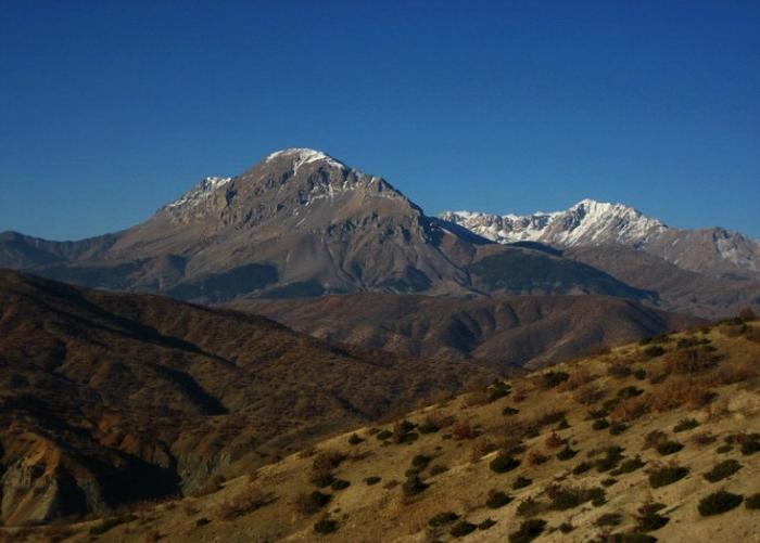
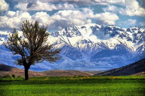
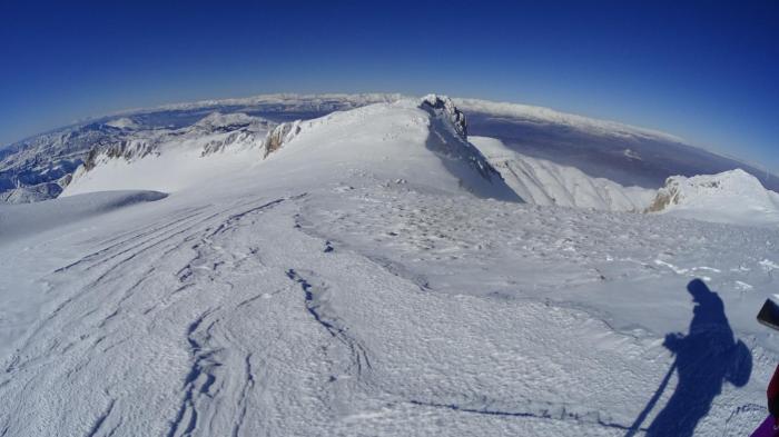
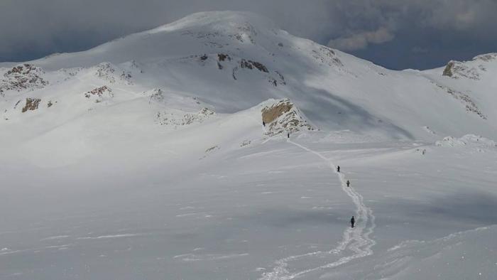
Mount Berit or Berit Dağ is about 3090 meters high at its summit. It is a majestic mountain, snow-covered 10 months out of the year, and has ancient iron ore mines not too far below its peak. Those iron ore mines were discovered and mined commercially by the Zeytoun Armenians who lived in Zeytoun and surrounding villages, just S of Berit mountain from the yrs 1048-1071 AD until 1915, the year which in April the Forced Deportation & Armenian Genocide was ordered by the Osmanli Turkish Ittihad-ve-Terakki ruling government masonic party.
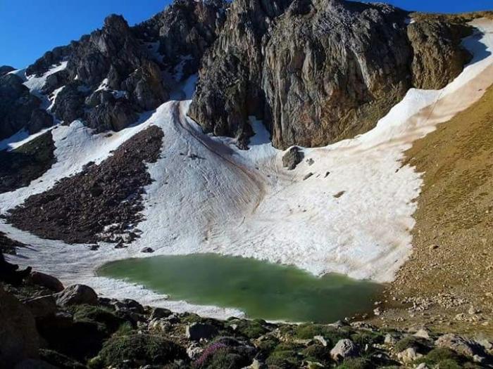
Berit mountain has over 200 indigenous varieties of flora and fauna, the most significant flower being the Moushq or Geyik Göbeği flower which only grows at elevations above 2500 meters, and even after it is picked and dried, it keeps its aromatic perfume for up to 20 years... Berit mountain is the headwaters for Zeytin Dere or the Şuğor creek which flows south into Zeytoun and then merges with Tzor stream and then into Antolp creek ( Fırnız çay ) and they all flow into the Güredin Su ( Güreddin creek ) which further flows into the Ceyhan (Djeyhan) river which flows into the Mediterranean sea.. Berit Mountain also hosts migrating species of famous partridge/quail called " Oor Qakav" or in Turkish "Ur Kekliği" which is a very beautiful game bird the size of a large rooster with an exotic birdsong which is hunted in February.
Berit mountain has over 200 indigenous varieties of flora and fauna, the most significant flower being the Moushq or Geyik Göbeği flower which only grows at elevations above 2500 meters, and even after it is picked and dried, it keeps its aromatic perfume for up to 20 years... Berit mountain is the headwaters for Zeytin Dere or the Şuğor creek which flows south into Zeytoun and then merges with Tzor stream and then into Antolp creek ( Fırnız çay ) and they all flow into the Güredin Su ( Güreddin creek ) which further flows into the Ceyhan (Djeyhan) river which flows into the Mediterranean sea.. Berit Mountain also hosts migrating species of famous partridge/quail called " Oor Qakav" or in Turkish "Ur Kekliği" which is a very beautiful game bird the size of a large rooster with an exotic birdsong which is hunted in February.
Nearby cities:
Coordinates: 38°1'9"N 36°52'40"E
- Mt. Dziasar 22 km
- Saharij cliffs 210 km
- Mt. K'ark'e 390 km
- Avatamk' 394 km
- Jabal Abū Rabāḩ (917 m) 397 km
- Mt. Sevsar 411 km
- Ridge east of 1305 m - summit 464 km
- Peak Sarakn 470 km
- Hermon mountain summit (2814m) 519 km
- Aladag (Mt. Surb Khach) 565 km
- BERİT Mountain 2.7 km
- Kemallı Göleti 11 km
- Kahramanmaraş Province 15 km
- Küçüksu (Gücük) 20 km
- Cemetery 21 km
- GOVERNMENT HOSPITAL OF AFŞİN 24 km
- Mosque 26 km
- ESHAB-I KEHF 26 km
- Afşin District 36 km
- Kayseri Province 100 km