Monasterboice
Ireland /
Louth /
Drogheda /
World
/ Ireland
/ Louth
/ Drogheda
World / Republic of Ireland
ruins, cemetery, archaeological site, monastery, interesting place, historic ruins
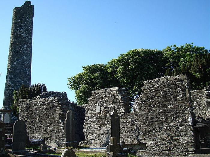
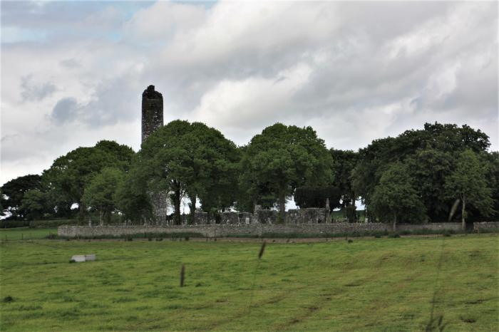
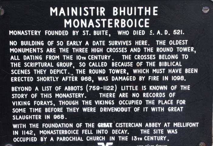
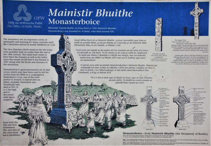
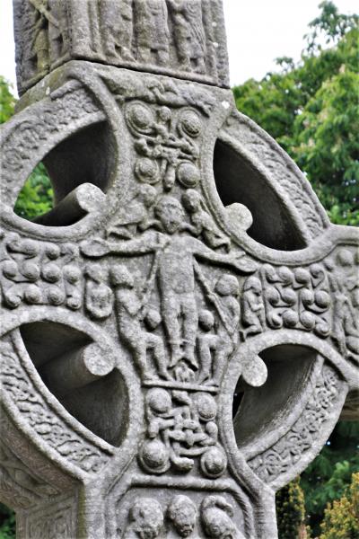
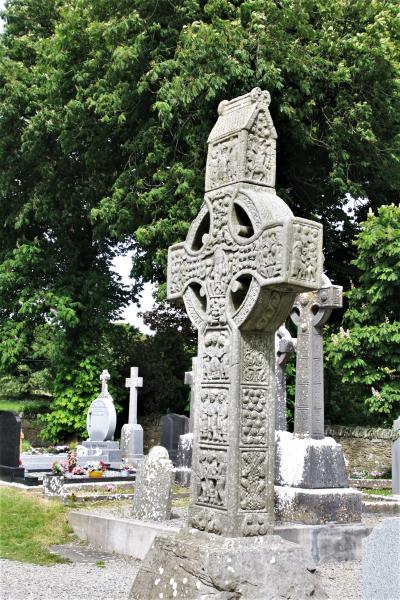
Monasterboice is a ruined monastery from the 6th century, with three fine examples of Celtic high crosses and a tower in which the monks took refuge when under attack by the Vikings. The town is recorded under attack in 1097. The area of the old monastery is now an old graveyard.
Wikipedia article: http://en.wikipedia.org/wiki/Monasterboice
Nearby cities:
Coordinates: 53°46'39"N 6°25'3"W
- boyne Sand flats 8.8 km
- Dunsany Castle 30 km
- Carlingford (Cairlinn) (Kerling Fjorthr) 33 km
- National Sports Campus 42 km
- Loughcrew (Loch Craobh) 48 km
- Bray Head Railway Line 68 km
- Shannon-Erne Waterway / Uiscebhealach na Sionainne-na hÉirne 90 km
- The Great Heath of Maryborough 95 km
- Slieve Bloom Mountains (Sliabh Bladhma) 112 km
- Lough Key Forest Park 124 km
- Medieval Village Site 3.6 km
- Gallstown Quarry 4.3 km
- Piperstown House 4.5 km
- M1 (Junc. 14) 9 km
- Rockfield Close 11 km
- Ardee Golf Club 13 km
- County Louth (Contae Lú) 14 km
- Applegreen Castlebellingham M1 Northbound 17 km
- County Meath (Contae na Mí) 28 km
- County Monaghan (Contae Mhuineacháin) 55 km