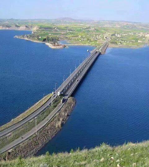
Qarah Qawzaq Bridge (not collapsed part)
| building/structure currently being renovated/restored/reconstructed
Syria /
Hhalab /
Manbij /
World
/ Syria
/ Hhalab
/ Manbij
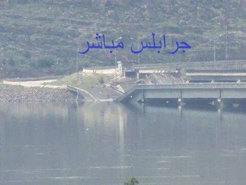
, 28 km from center (منبج)
World / Syria / Aleppo
building/structure currently being renovated/restored/reconstructed, bridge
Alt: Qereqozax; Qara Qawzaq; Qarra Qawzaq; Qere Qowzaq; Qara Qozak; Kara Kozak
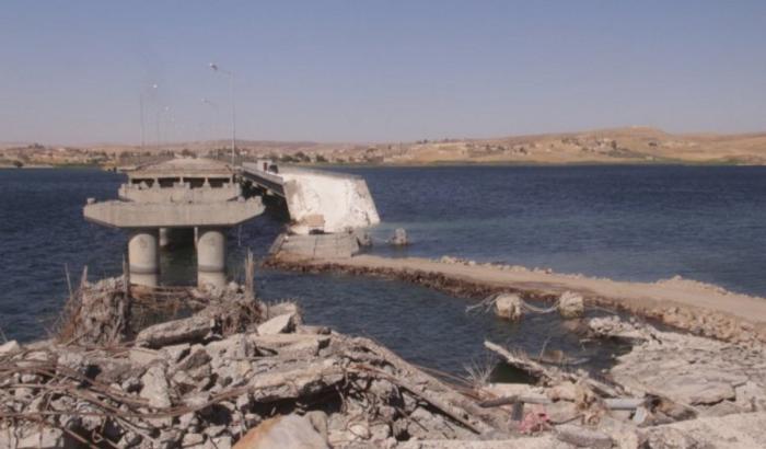
M4 Hwy bridge spanning Euphrates River connecting Manbij from west to Sarrin -> Ayn Issa -> Qamishli on the east
There are two separate, side-by-side structures (one slightly lower than the other) that used to make up the bridge.
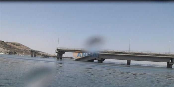
Photos from 2 June 2016 show the complete collapse of the last span of both bridge lanes to the side of Manbij/Membic.
The Semi-collapse of the second last span of the south lane on the Manbij/Membic side.
And for a small distance the semi-collapse of the last bridge span of both bridge lanes on the Qarah Qawzaq/Kobani side.
This renders the bridge completely unusable for all traffic in both directions, but 70% of the bridge lanes over the water is still undamaged.
Timeline:
21 Sep 2014 SAAF targets bridge in bombing campaign
14 March 2015 ISIL demolition failed to cut the Qereqozax Bridge (pic)
20 March 2015 coalition airstrikes resulted in the complete collapse of the last span of both bridge lanes to the side of Manbij/Membic. The Semi-collapse of the second last span of the south lane on the Manbij/Membic side. And (for a small distance) the semi-collapse of the last bridge span of both bridge lanes on the Qarah Qawzaq/Kobani side.
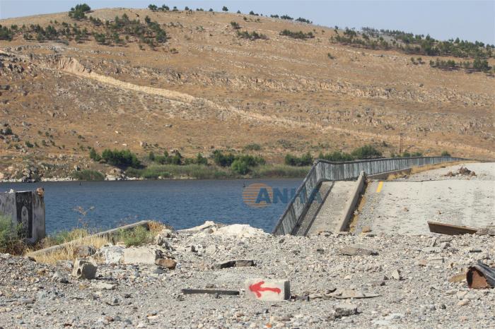
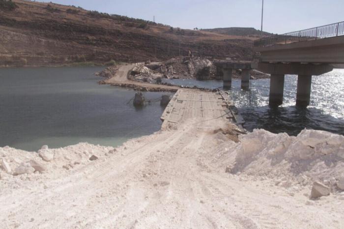
01 Jun 2016 SDF utilized military pontoon boat crossing with 2 floatable docks on both sides of the river just to the south of the bridge. *To be determined: Unclear if boat crossing is permanent or really replaces bridge even on temporary basis. SDF/QSD used boats to cross for Manbij campaign, but no indication if there will be continued military use or civilian traffic carried.
M4 Hwy bridge spanning Euphrates River connecting Manbij from west to Sarrin -> Ayn Issa -> Qamishli on the east
There are two separate, side-by-side structures (one slightly lower than the other) that used to make up the bridge.
Photos from 2 June 2016 show the complete collapse of the last span of both bridge lanes to the side of Manbij/Membic.
The Semi-collapse of the second last span of the south lane on the Manbij/Membic side.
And for a small distance the semi-collapse of the last bridge span of both bridge lanes on the Qarah Qawzaq/Kobani side.
This renders the bridge completely unusable for all traffic in both directions, but 70% of the bridge lanes over the water is still undamaged.
Timeline:
21 Sep 2014 SAAF targets bridge in bombing campaign
14 March 2015 ISIL demolition failed to cut the Qereqozax Bridge (pic)
20 March 2015 coalition airstrikes resulted in the complete collapse of the last span of both bridge lanes to the side of Manbij/Membic. The Semi-collapse of the second last span of the south lane on the Manbij/Membic side. And (for a small distance) the semi-collapse of the last bridge span of both bridge lanes on the Qarah Qawzaq/Kobani side.
01 Jun 2016 SDF utilized military pontoon boat crossing with 2 floatable docks on both sides of the river just to the south of the bridge. *To be determined: Unclear if boat crossing is permanent or really replaces bridge even on temporary basis. SDF/QSD used boats to cross for Manbij campaign, but no indication if there will be continued military use or civilian traffic carried.
Nearby cities:
Coordinates: 36°38'4"N 38°12'10"E
- US-SDF Military pontoon ferry and docks 0.3 km
- al-Nasiriyyah Bridge (destroyed) 24 km
- Dadat Bridge (destroyed) 24 km
- Jarablus Wooden Bridge 26 km
- Train trestle bridge 27 km
- Roman Bridge 111 km
- Cendere Bridge 149 km
- Nissibi Euphrates Bridge 156 km
- Beylerderesi Viyadüğü 190 km
- Kömürhan Bridge 208 km
- Mountain (480 m) 2.4 km
- U.S. Military Compound 2.9 km
- South Hammam mountain (512 m) 2.9 km
- North Hammam mountain (495 m) 2.9 km
- Ja‘dah Kabīrah (submerged) 3.3 km
- Ja‘dah Şaghīrah (submerged) 4.3 km
- Mountain (460 m) 4.3 km
- Tishrin Dam reservoir 7.5 km
- Manbij-Birecik Plain 24 km
- Euphrates Region (DFNS) 70 km
Comments