Savur-Mohyla
Ukraine /
Donetska /
Pervomayskyy /
World
/ Ukraine
/ Donetska
/ Pervomayskyy
, 8 km from center (Первомайський)
World / Ukraine / Donets'k
Second World War 1939-1945, battlefield, barrow/tumulus/burial mound, war memorial


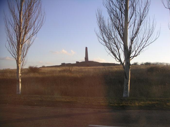


Savur-Mohyla (Ukrainian: Савур-могила), from Russian is transcribed as Saur-Mogila (Russian: Саур-Могила) - is a strategic height in the Donets ridge near the city of Snizhne, located about 5 km (3.1 mi) away from the border between Ukraine (Donetsk Oblast) and Russia (Rostov Oblast).
Wikipedia article: http://en.wikipedia.org/wiki/Savur-Mohyla
Nearby cities:
Coordinates: 47°55'20"N 38°44'14"E
This article is protected.
- Pond 1.7 km
- Pond 2 km
- Pond 2.1 km
- Petrivskyi Pond 4.8 km
- Regional Landscape Park "Donetsk Ridge " 5.5 km
- The dried reservoir 5.9 km
- Kryvyi Forest 6.3 km
- Reservoir 6.4 km
- Pond 7.1 km
- Remivka 7.9 km