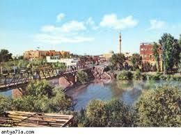
Al-'Uthmaniyah (Deir Ezzor)
Syria /
Dayr-az-Zawr /
Dayr az-Zawr /
Deir Ezzor
World
/ Syria
/ Dayr-az-Zawr
/ Dayr az-Zawr
, 3 km from center (دير الزور)
World / Syria / Dayr Az Zawr
district, neighbourhood
Nearby cities:
Coordinates: 35°20'17"N 40°9'13"E
- Hesîçe/Hasakah Area (DFNS) 164 km
- Baiji District (ICR) 212 km
- Tikrit District (ICR) 273 km
- Dibis District 330 km
- Al-Daur District (ICR) 333 km
- Erbil District 342 km
- Kirkuk District 354 km
- Tooz District 379 km
- Koye District 382 km
- Qandil District 425 km
- commercial Center and Hassan Attaha street 1 km
- al-Sefsef Island 1.2 km
- Faculty of Human Medicine, University of Euphrates 1.6 km
- Deir ez-Zor Train Station 1.9 km
- Hawijat Kati` Island 2.2 km
- Mahattah al-Qitar (Train station district) 3 km
- Hatlah District 3.4 km
- Deir ez-Zor Civil Council (DFNS) 32 km
- Markaz Deir ez-Zor Subdistrict 40 km
- Deir ez-Zor Governorate (PCS) 46 km
commercial Center and Hassan Attaha street
al-Sefsef Island
Faculty of Human Medicine, University of Euphrates
Deir ez-Zor Train Station
Hawijat Kati` Island
Mahattah al-Qitar (Train station district)
Hatlah District
Deir ez-Zor Civil Council (DFNS)
Markaz Deir ez-Zor Subdistrict
Deir ez-Zor Governorate (PCS)