Wreck of the Otavi
Namibia /
Karas /
Luderitz /
World
/ Namibia
/ Karas
/ Luderitz
World
shipwreck
Add category
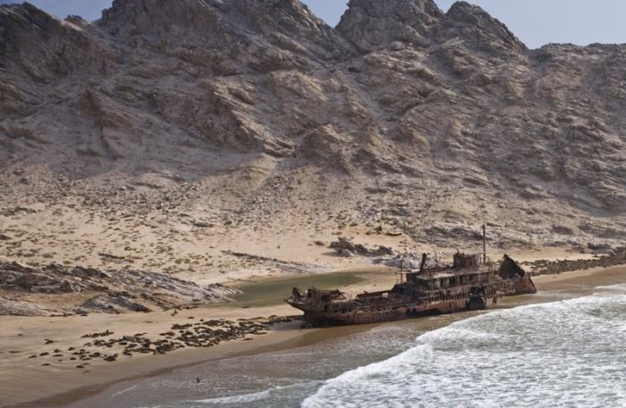
Ran aground in 1945, Spencer Bay, carrying guano. It is seen surrounded by Cape fur seals.
Nearby cities:
Coordinates: 25°43'56"S 14°49'59"E
- Wreck MTS Oceanos 1560 km
- Wreck of Katina P 1818 km
- Pandu Bahari bunker barge sunk 31/07/2011 10002 km
- Location of oil spill estimates of the missing Indonesian submarine KRI Nanggala 402 10632 km
- App. place of HMAS Warrnambool (J202) wreck 13067 km
- Wreck of USS Lexington (CV-2) 13794 km
- Wreck of HIJMS Shōhō (祥鳳) 13966 km
- Ironbottom Sound 14619 km
- Wreck of USS Hornet (CV-8) 15148 km
- RMS Niagara(wreck) 15915 km
- Hottentot bay 45 km
- Koichab Depression 96 km
- Kirchberg 108 km
- Lüderitz peninsula 110 km
- Elizabeth Bay diamond mine 136 km
- NamibRand Nature Reserve 139 km
- Elizabeth Bay 139 km
- Fairy Circles in the grasslands of the Namib Desert 140 km
- Erfstuk 151 km
- Kahlerberg 178 km
Comments