Lalmohan Upazila HQ
Bangladesh /
Bhola /
Lalmohan /
World
/ Bangladesh
/ Bhola
/ Lalmohan
World / Bangladesh / Chittagong / Noakhali / Noakhali
township, subdistrict, fourth-level administrative division, local government
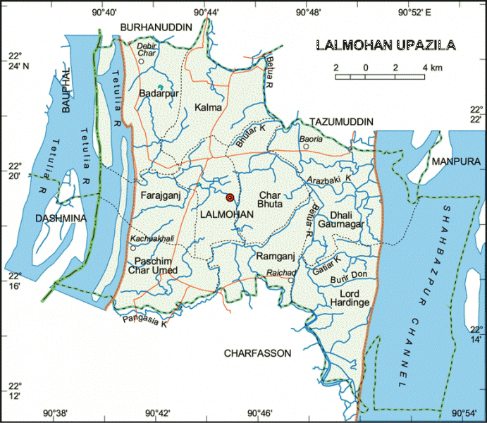
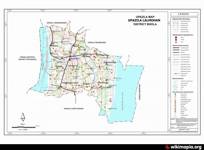

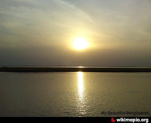
Lalmohan Upazila (Bhola district) with an area of 396-24 sq km, is bounded by Burhanuddin and Tazumuddin upazilas on the north, charfasson upazila on the south, Manpura upazila on the east, Dashmina and Bauphal upazilas on the west. Main rivers are Tentulia and Meghna (lower).
The location of the Lalmohan town is 22.3297006N 90.7320446E. Lalmohan (Town) consists of 9 wards and 14 mahallas. The area of the town is 21.65 sq km. It has a population of 17310; male 51.08%, female 48.92%; density of population is 1288 per sq km. Literacy rate among the town people is 28.38%.
Lalmohan thana was established in 1919 and was turned into an upazila in 1983. The upazila consists of 1 municipality, 9 union parishads, 54 mouzas, 76 villages.
s of the 1991 Bangladesh census: Population 252497; male 50.76%, female 49.24%; Muslim 91.28%, Hindu 8.7%, Christian 0.02%.
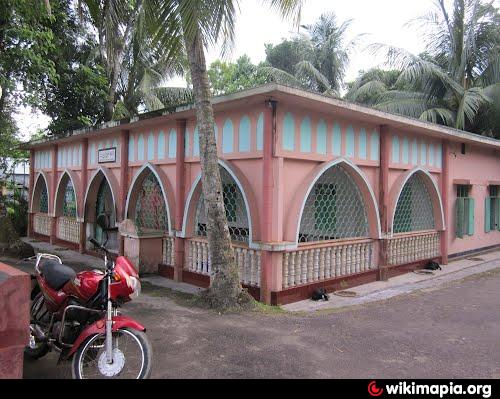
Religious institutions Mosque 352, temple 13.
Literacy and educational institutions: Average literacy 20.20%; male 25.70%, female 14.70%. Educational institutions: college 3, secondary school 18, lower secondary school 4, government primary school 72, non-government primary school 104, madrasa 33, maktab 300.
Cultural organisations: Club 32, public library 1, cinema hall 4, literary society 2, ladies' club 2, playground 18
Main occupations: Agriculture 41.4%, fishing 3.8%, agricultural labourer 27.01%, wage labourer 3.89%, commerce 8.29%, service 3.15%, transport 1.65%, others 10.81%.
Land use: Total cultivation land 25740 hectares, fallow land 11135 hectares.
Land control: Among the peasants, 8.32% are landless, 46.77% marginal, 31.30% intermediate and 13.61% rich; land 0.15 hectare per head.
Fisheries, poultries Fishery 45, poultry 32.
Communication facilities- Roads: pucca 39.33 km and mud road 399.30 km.
Cottage industries: Bamboo and cane work, goldsmith, blacksmith, wood work, tailoring.
NGO activities: Operationally important NGO's are brac, asa, RASA, Coast, Duke, Rural Development.
Health centres: Upazila health complex 1, union health and family welfare centre (RD) 7.
The location of the Lalmohan town is 22.3297006N 90.7320446E. Lalmohan (Town) consists of 9 wards and 14 mahallas. The area of the town is 21.65 sq km. It has a population of 17310; male 51.08%, female 48.92%; density of population is 1288 per sq km. Literacy rate among the town people is 28.38%.
Lalmohan thana was established in 1919 and was turned into an upazila in 1983. The upazila consists of 1 municipality, 9 union parishads, 54 mouzas, 76 villages.
s of the 1991 Bangladesh census: Population 252497; male 50.76%, female 49.24%; Muslim 91.28%, Hindu 8.7%, Christian 0.02%.
Religious institutions Mosque 352, temple 13.
Literacy and educational institutions: Average literacy 20.20%; male 25.70%, female 14.70%. Educational institutions: college 3, secondary school 18, lower secondary school 4, government primary school 72, non-government primary school 104, madrasa 33, maktab 300.
Cultural organisations: Club 32, public library 1, cinema hall 4, literary society 2, ladies' club 2, playground 18
Main occupations: Agriculture 41.4%, fishing 3.8%, agricultural labourer 27.01%, wage labourer 3.89%, commerce 8.29%, service 3.15%, transport 1.65%, others 10.81%.
Land use: Total cultivation land 25740 hectares, fallow land 11135 hectares.
Land control: Among the peasants, 8.32% are landless, 46.77% marginal, 31.30% intermediate and 13.61% rich; land 0.15 hectare per head.
Fisheries, poultries Fishery 45, poultry 32.
Communication facilities- Roads: pucca 39.33 km and mud road 399.30 km.
Cottage industries: Bamboo and cane work, goldsmith, blacksmith, wood work, tailoring.
NGO activities: Operationally important NGO's are brac, asa, RASA, Coast, Duke, Rural Development.
Health centres: Upazila health complex 1, union health and family welfare centre (RD) 7.
Nearby cities:
Coordinates: 22°20'15"N 90°44'16"E
- Patiya Upazila (পটিয়া) 109 km
- Banshkhali Upazila (বাঁশখালী উপজেলা) 116 km
- Chandanaish Upazila 124 km
- Matlab Upazila (North) Area 131 km
- Lohajang Upazila 144 km
- Keraniganj Upazila 165 km
- Rupganj Upazila 181 km
- Kapashia Upazila 216 km
- Gafargaon Upazila 247 km
- Dhobaura Upazila 321 km
- Bhola District 17 km
- island - mud flat - sand bar 25 km
- Shore protection 31 km
- Lower Meghna River 37 km
- Hatiya, Noakhali 39 km
- Barishal Division 41 km
- Nijhum Dwip (Nijhum Island) 42 km
- Proposed Special Economic Zone 43 km
- Noakhali District 47 km
- Thengar Char 68 km
Comments