Weddington Information Board (Nuneaton)
United Kingdom /
England /
Nuneaton /
A444 Weddington Road
World
/ United Kingdom
/ England
/ Nuneaton
World / United Kingdom / England
tourist information board
Add category
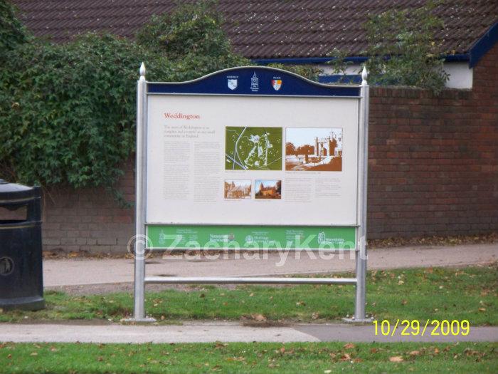

This is the Weddington Information Board, it has the information of the Weddington area and the history of Weddington’s area. It shows a very old map of how Weddington was in the past, and a few old photos of noticeable buildings in the Weddington area.
Nearby cities:
Coordinates: 52°31'51"N 1°27'48"W
- Bridgnorth 67 km
- Prom Coffee Shop and Tourist Information Centre 168 km
- Tourist Information Office 321 km
- Glendalough Visitor Centre & Car Park 332 km
- Skerries Mill 332 km
- Edinburgh tour bus stop 397 km
- Loch Lomond Shores 437 km
- Waterville Tourist Information Office 599 km
- Hof 1733 km
- Esjan 1742 km
- Nuneaton Cricket Club 0.2 km
- Nuneaton Old Edwardians RFC 0.3 km
- Weddington (suburb) 0.5 km
- Sandon Park 0.7 km
- Abbey Green 0.8 km
- Abbey 0.8 km
- Weddington 1 km
- St Nicolas 1.4 km
- Hartshill 3.5 km
- Warwickshire 25 km