Thorp Ford Covered Bridge
USA /
Indiana /
Rosedale /
World
/ USA
/ Indiana
/ Rosedale
covered bridge
Add category
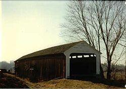
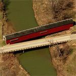
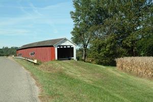
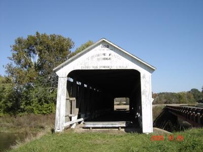
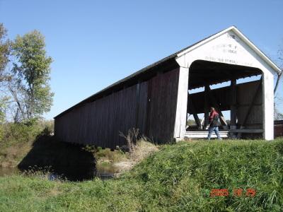
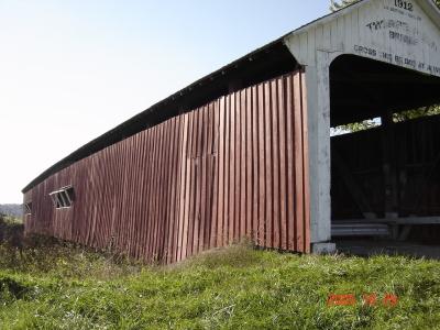
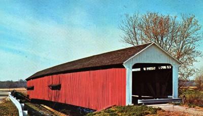
The Thorpe Ford Covered Bridge is northeast of Rosedale, Indiana. The single span Burr Arch Truss covered bridge structure was built by Joseph A. Britton in 1912
Wikipedia article: http://en.wikipedia.org/wiki/Thorpe_Ford_Covered_Bridge
Nearby cities:
Coordinates: 39°38'13"N 87°15'58"W
- Bell Ford Bridge 137 km
- Shadyside Recreation Area 147 km
- Restored Covered Bridge & Park 209 km
- Bollinger Mill State Historic Site 336 km
- Clearbranch Methodist Baptist Church and Covered Bridge 665 km
- Abandoned Bridge Piers 812 km
- Pennsylvania Railroad Bridge (Ruins/Demolished) 919 km
- Conowingo Bridge (Former Site) 947 km
- Port Deposit Bridge remnants 953 km
- Covered Bridge Park 1622 km
- HECK'S GATE 1 7.9 km
- Taghleef Industries 10 km
- Haven Cemetery 12 km
- Markles Cemetery 15 km
- Parke County, Indiana 16 km
- Vigo County, Indiana 26 km
- Vermillion County, Indiana 31 km
- Clay County, Indiana 32 km