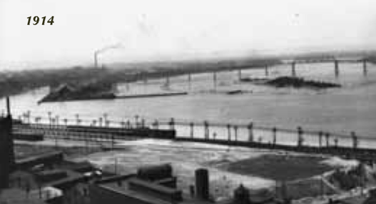
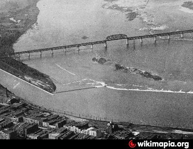
Corn Island (submerged) (Louisville-Jefferson County, Kentucky)
USA /
Indiana /
Jeffersonville /
Louisville-Jefferson County, Kentucky
World
/ USA
/ Indiana
/ Jeffersonville
World / United States / Kentucky
island, underwater, historical layer / disappeared object


Originally Dunmore's Island (1773)
Quarried and submerged.
In the spring of 1778, George Rogers Clark along with about 150 militia and 13 families,
rafted down the Ohio River and landed near the Falls on Corn Island. Clark and his men
soon left on their quest to conquer the Northwest Territory. The settlers who remained
behind moved to the southern shore of the Ohio and built "Fort on Shore", at the foot of
present day 12th Street, which lasted only three years. The town that they eventually
established would become known as Louisville to honor both the French King Louis XVI
and the vital role of the people of France in the Revolutionary War.
Wikipedia article: http://en.wikipedia.org/wiki/Corn_Island_(Kentucky)
Nearby cities:
Coordinates: 38°15'57"N 85°46'0"W
- Town of Ohio Falls (1854-1875) 4.1 km
- Camp Powers 4.3 km
- Clarksville Airport 5 km
- Hamburg, Indiana 13 km
- Heritage Creek, Kentucky 15 km
- Indiana Army Ammunition Plant 24 km
- Track of March, 2012 Tornado 32 km
- Former Railroad Bed 45 km
- Dog Walk Civil War Battlefield 73 km
- former site of Burnside 175 km
- Downtown Louisville (Central Business District) 1.8 km
- Russell neighborhood 2.1 km
- Ohio River Greenway 2.2 km
- Portland neighborhood 2.3 km
- California neighborhood 2.9 km
- Butchertown Neighborhood 3.4 km
- West End 3.5 km
- Old Louisville/Limerick Neighborhood 3.9 km
- Floyd County, Indiana 12 km
- Clark County, Indiana 20 km