Ánir
| village
Faroe Islands /
Klaksvik /
Anirnar /
World
/ Faroe Islands
/ Klaksvik
/ Anirnar
World / Faroe Islands / Norderøerne
village
Add category
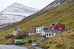
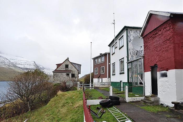
Ánir lies about 3 km north of the northern isles' capital Klaksvík on the west coast of Borðoy and was founded in 1840, as the increasing population demanded more land for cultivation.[1] Facing the village is the southern tip of the island Kunoy. The road through Ánir continues to Strond and then crosses the causeway to the island of Kunoy to continue to the villages of Haraldssund and Kunoy. High over Ánir is the entrance of a road tunnel to Árnafjørður and on to the island of Viðoy.
Wikipedia article: http://en.wikipedia.org/wiki/Ánir
Nearby cities:
Coordinates: 62°15'6"N 6°34'43"W
- Fuglafjørður 13 km
- Viðareiði 13 km
- Skáli 15 km
- Kollafjørður 24 km
- Eiði 28 km
- Argir 30 km
- Sandavágur 37 km
- Miðvágur 40 km
- Sørvágur 44 km
- Sandur 45 km
- Borðoy 3 km
- Haraldssund 6.3 km
- Leirviksfjørður 7 km
- Kunoy 7.2 km
- Kalsoyarfjørður 8.5 km
- Kalsoy 10 km
- Eystur Municipality 11 km
- Svínoy 12 km
- Eysturoy 15 km
- Faroe Islands 43 km