Kara Kul Lake
Tajikistan /
Gorno-Badakhshan /
Murgob /
World
/ Tajikistan
/ Gorno-Badakhshan
/ Murgob
World / Tajikistan / Gorno-Badakhshan / Murghob
salt lake, astrobleme

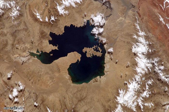
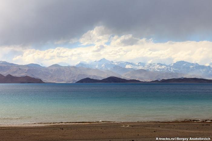
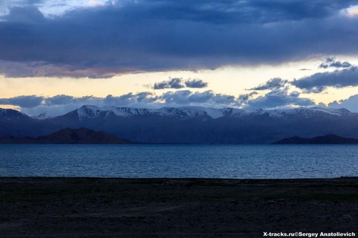
Kara-Kul is a 25-kilometer (16-mile) diameter lake in the Pamir Mountains in Tajikistan, and lies at an altitude of 3,900 meters (13,000 feet) above mean sea level. Kara-Kul was formed by a meteorite impact event less than 5 million years ago, leaving a crater with a rim diameter of 45 kilometers (28 miles).
A peninsula projecting from the south shore and an island off the north shore divide it into two basins, a smaller eastern one which is shallow, 13 to 19 meters, and a larger western one, which has depths of 221 to 230 meters. It has no drainage outlet. Interestingly, the Kara-Kul impact structure remained unidentified until it was discovered though studies of imagery taken from space.
A peninsula projecting from the south shore and an island off the north shore divide it into two basins, a smaller eastern one which is shallow, 13 to 19 meters, and a larger western one, which has depths of 221 to 230 meters. It has no drainage outlet. Interestingly, the Kara-Kul impact structure remained unidentified until it was discovered though studies of imagery taken from space.
Wikipedia article: http://en.wikipedia.org/wiki/Karakul_(Tajikistan)
Nearby cities:
Coordinates: 39°0'38"N 73°25'34"E
- Shiva Crater 2236 km
- Kamensk impact crater 2836 km
- Puchezh-Katunki crater 2986 km
- Logancha Impact Crater 3285 km
- Kara Meteorite Crater 3428 km
- Popigai Impact Crater 4190 km
- Lake Lappajärvi 4236 km
- Siljan impact crater 4649 km
- Gilf Kebir Crater Field 4689 km
- Nördlinger Ries 5017 km
- North Island 8.1 km
- Island 11 km
- Lake 32 km
- Kyzylart Pass 43 km
- Kurumdy Mountain (6,614 m/21,699 ft) 51 km
- Tajikistan-Kyrgyzstan-China tripoint 52 km
- Epicenter of m4.8 quake 53 km
- border fortifications 87 km
- Taldyk Pass (3.599 m) 87 km
- Chinese customs/immigration checkpoint 88 km