Cape Sutil
Canada /
British Columbia /
Port Hardy /
World
/ Canada
/ British Columbia
/ Port Hardy
World / Canada / British Columbia / Mount Waddington
cape (geography)
Add category
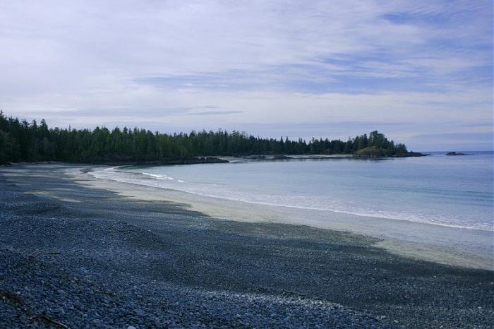

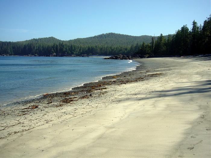
Northernmost point on Vancouver Island. Former site of the First Nations village of “Nahwitti”, rich in cultural heritage.
www.env.gov.bc.ca/bcparks/explore/parkpgs/cape_scott/hi...
www.env.gov.bc.ca/bcparks/explore/parkpgs/cape_scott/hi...
Nearby cities:
Coordinates: 50°52'25"N 128°3'25"W
- Cape Spencer 996 km
- Cape Black Point 1780 km
- Cape Kekurnol 1917 km
- Cape Kumlik 2028 km
- Cape Kumliun 2061 km
- Strigonof Point 2115 km
- Cape Aliaksin 2224 km
- Cape Rozhnof 2237 km
- Cape Glazenap 2368 km
- Los Cabos 3468 km
- Shuttleworth Bight 6.1 km
- Hope Island 11 km
- Cape Scott Wind Farm 12 km
- Cape Scott Provincial Park 25 km
- Hansen Lagoon 25 km
- Scott Channel 33 km
- Cox Island 39 km
- Lanz Island 45 km
- Triangle Island 72 km
- Calvert Island 76 km