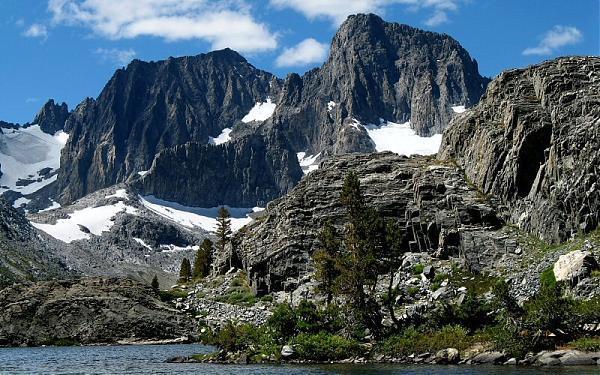
Banner Peak
USA /
California /
Mammoth Lakes /
World
/ USA
/ California
/ Mammoth Lakes
World / United States / California
mountain
Add category


Elevation 12,936 feet (3943 meters)
Clean prominence 856 feet.
Key col 12,080 feet.
First ascent 1883 by Willard Johnson and John Miller.
First winter ascent 1939 by Erret, Brinton and Warner.
The easiest route to Banner Peak is class 2 from the Ritter-Banner saddle, vía Lake Catherine, ascending its southwest slope. The west side of the saddle is a steep snow chute at all times of the year. In early season (through July) it may be a simple manner of kicking steps when the snow is soft. Later in the season it can be icy and imposing. If going by way of the Ritter-Banner Saddle from the east side, the route steepen to 3rd class as the snow gully narrows. Rock fall is always present and vigilance is required. Routes on Banner Peak's other faces and buttresses are much more challenging.
At one time this whole area was part of Yosemite, but it was detached in 1905 due to conflicting issues over mineral rights in the area.
Yellow outline traces the 12,200 foot contour line.
Photo looking down on Banner Peak is from the summit of Mount Ritter, about one kilometer to the south and west. (Note Mono Lake very faintly visible in the far distance, just over Banner summit.)
peakbagger.com/peak.aspx?pid=2625
www.wilderlist.app/mountain/5f04d20f676f544db0f0d782
Wikipedia article: http://en.wikipedia.org/wiki/Banner_Peak
Nearby cities:
Coordinates: 37°41'47"N 119°11'41"W
- Mount Ritter 1 km
- Volcanic Ridge 3.1 km
- the Minarets 3.2 km
- Mammoth Mountain 13 km
- Long Valley Caldera 16 km
- Mount Bruce 29 km
- Casa Diablo Mountain 57 km
- Mount Tom 60 km
- White Mountains 84 km
- Mount Campbell 112 km
- Thousand Island Lake 2.8 km
- Washburn Lake 16 km
- Cattle Mountain 20 km
- Quartzite Peak 20 km
- Grayling Peak 21 km
- epicenter of M2.6 quake on 2015-07-26 at 04:08:06 (UTC) 22 km
- Chain Lakes 23 km
- Mount Bruce 29 km
- Yosemite National Park 35 km
- Inyo National Forest 84 km