Chornogora
Ukraine /
Ivano-Frankivska /
Vorokhta /
World
/ Ukraine
/ Ivano-Frankivska
/ Vorokhta
, 19 km from center (Ворохта)
World / Ukraine / Transcarpathia
ridge, draw only border

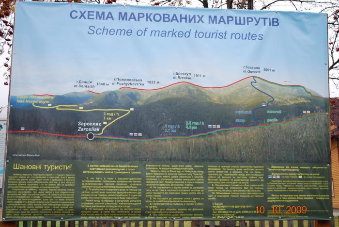


Wikipedia article: http://uk.wikipedia.org/wiki/Чорногора
Nearby cities:
Coordinates: 48°6'47"N 24°31'17"E
- Turkul 2.2 km
- Shpyci mt. 3 km
- Holovcheska polonyna (meadow) 10 km
- Brayivka polonyna (meadow) 22 km
- Bilyna polonyna (meadow) 24 km
- Donesivka polonyna (meadow) 26 km
- Mount Synyak 31 km
- Bukovel 33 km
- Yamna 37 km
- Svydovets 51 km
Comments