Western CTA Orange Line Station (Chicago, Illinois)
USA /
Illinois /
Chicago /
Chicago, Illinois /
South Western Avenue, 4901
World
/ USA
/ Illinois
/ Chicago
World / United States / Illinois
Chicago Transit Authority (CTA), train station, bus stop, metro station
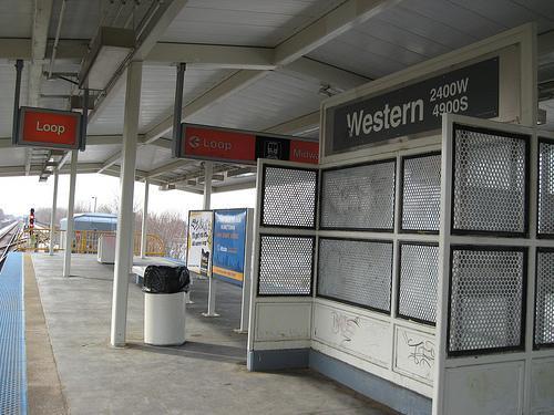
Western avenue stop for the orange line
Wikipedia article: http://en.wikipedia.org/wiki/Western_(CTA_Orange_Line)
Nearby cities:
Coordinates: 41°48'18"N 87°41'3"W
- Palos Heights Metra Station 17 km
- IHB Rose Yard 20 km
- Tinley Park (80th Avenue) Metra Station 29 km
- Mokena Hickory Creek Metra Station 32 km
- University Park Metra Station 38 km
- Schaumburg Metra Station 42 km
- Elburn Metra Station 66 km
- Crystal Lake Metra Station 72 km
- Wauponsee Station (site) 90 km
- Muskego Yard 138 km
- Gage Park 1.5 km
- New City 2 km
- Back of The Yards 2 km
- Archer Heights 3.5 km
- West Englewood 3.6 km
- West Elsdon 3.6 km
- Chicago Lawn 3.8 km
- Marquette Park 4.4 km
- West Lawn 5.3 km
- Cook County, Illinois 17 km