Majdal Shams
Syria /
al-Qunaytirah /
World
/ Syria
/ al-Qunaytirah
/ al-Qunaytirah
, 14 km from center (القنيطرة)
World / Israel
village
Add category
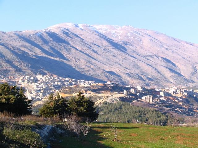
Druze village, fascinating architecture. This is the highest community in the Golan Heights, whose Arabic name means "Tower of the Sun"
www.youtube.com/watch?v=T9p-vPp32lU
www.youtube.com/watch?v=T9p-vPp32lU
Wikipedia article: http://en.wikipedia.org/wiki/Majdal_Shams
Nearby cities:
Coordinates: 33°15'56"N 35°46'7"E
- Hader 5.3 km
- Ebil El Saki 19 km
- Al Khiyam 19 km
- Marjeyoun 21 km
- Deir Mimas 22 km
- Al Adeisseh 22 km
- Markaba 26 km
- Hula 27 km
- Blida 28 km
- Mays Al Jabal 28 km
- Shebaa Farms 7.1 km
- Odem Forest 8.3 km
- Military Zone 11 km
- Hasbaya District 12 km
- Mount Hermon/Jebel al-Shaykh 16 km
- Galilee Panhandle 20 km
- Nabatiyeh Governorate 20 km
- UNDOF Zone 21 km
- Golan Heights 29 km
- Golan Plateau 30 km