Runway 16/34
Canada /
British Columbia /
Ladysmith /
World
/ Canada
/ British Columbia
/ Ladysmith
World / Canada / British Columbia / Nanaimo
runway
Add category
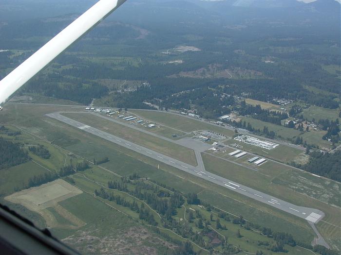

Runway 16/34
Dimensions: 6602 x 150 ft. / 2012 x 46 m
Surface: asphalt
Runway edge lights: high intensity
RUNWAY 16 RUNWAY 34
Traffic pattern: left right
Runway heading: 142 magnetic, 161 true 322 magnetic, 341 true
Displaced threshold: 197 ft. 1002 ft.
Declared distances: TORA:6602 TODA:7094 ASDA:6602 LDA:6405 TORA:6602 TODA:7192 ASDA:6602 LDA:5600
Visual slope indicator: 4-light PAPI on left (3.00 degrees glide path) 4-light PAPI on left (3.50 degrees glide path)
Runway end identifier lights: yes yes
Nearby cities:
Coordinates: 49°3'20"N 123°52'12"W
- Runway Comox Valley Airport 105 km
- Runway Campbell River Airport 143 km
- Runway 11/29 310 km
- Runway 5/23 341 km
- Burns Lake Airport 610 km
- Runway 03/21 684 km
- Runway 725 km
- Runway 2/20 733 km
- Runway 13/31 738 km
- Runway 11/29 882 km
- Nanaimo Airport 0.3 km
- Cassidy 1.4 km
- Cedar 3.2 km
- South Wellington 4.7 km
- Yellow Point 6.6 km
- Cinnabar Valley 6.9 km
- Mudge Island 10 km
- De Courcy Island 11 km
- Gabriola Island 14 km
- Strait of Georgia 31 km