Fundata
Romania /
Brasov /
Fundata /
World
/ Romania
/ Brasov
/ Fundata
World / Romania
village
Add category


Common Fund is located at the south-eastern county of Brasov, at its limit with Arges and Dambovita and Leaota of Bucegi mountains are very close to the border with Prahova County. They are in fact neighbors west and south-west, the villages and Rucar Dambovicioara in Arges, in the east and north-eastern limit is the top Moieciu Bran villages, gorges and cave. Common Fund is crossed by one of the oldest roads connecting Transylvania and Romanian Country, namely the famous "corridor Bran - Rucar" (road in the Middle Ages was an important way of connecting Sitara Romanian Transylvania, linking the Cumidava Jidava ).
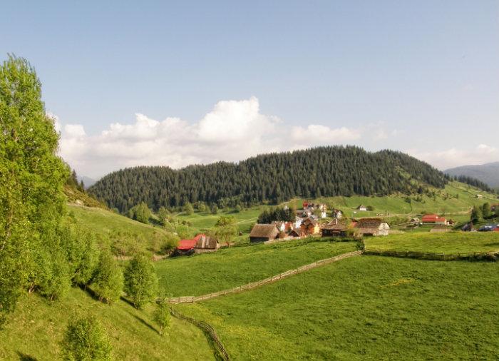
The town situated at the highest elevation in the country permanently inhabited, with the highest point at 1235m (Step Giuvala), sometimes with flats situated at 1300 m or 1400 m altitude.
Topography is quite hilly village, lowest rates falling below 800 m while the highest rates tend to 2000 m.
The river network is poorly represented and is unevenly distributed. Regional climate is temperate - continental excessive.
Soils are podzolic type, meager and thin, making drought settle quickly given that it does not rain for weeks.
Mountain and submontane flora is specifically protected by law including and plants such as Yellow Peony, Garofita Pietrii Mountains, Blood Voinicului. Fauna is not too different from the rest of the country and is represented by wolves, bears, foxes, wild boars, martens, rabbits and chickens rooster mountain, many species of birds, and water, trout.
Despite the hardships of time and nature background Romans continued to persist in this region, carved in stone mark their passage through life, forged an original civilization and unity. Continuing to inhabit these places is mentioned archaeological dark times, from prehistory through the stone tools and a fragment of femur of a woman who belonged to Homosapiens and the neighboring village were discovered in Cave.
Stpanirile foreign (Hungarian, Turkish, Austrian and Austro-Hungarian joint affected and Fundata. Here, in front of the former Austro-Hungarian customs, located near the border that separates arbitrary and unnatural in Romans on both sides of the Carpathians, Customs is now dispensary communal, the tomb officer martyr - holy war hero fell for unifying the nation: Colonel Poenaru board with his armies went odiasa border in summer 1916.
Wikipedia article: http://ro.wikipedia.org/wiki/Fundata,_Brașov
Nearby cities:
Coordinates: 45°26'41"N 25°17'31"E
- Cheile Gradistei Fundata 1 km
- Vick Cioaca - Ciocanu 3.9 km
- Valea Urdii 4 km
- Cave Dâmbovicioara 5.4 km
- Varful Santilia Mica 6.3 km
- Piatra Craiului Massif 7 km
- Dambovita's Gorges 10 km
- Sătic Lake 10 km
- Iezer-Papusa Mountain Group 23 km
- Brașov County 37 km
Comments