Godagari Upazila HQ
India /
Bangla /
Kankuria /
World
/ India
/ Bangla
/ Kankuria
World / Bangladesh / Rajshahi / Rajshahi / Rajshahi
township, subdistrict, fourth-level administrative division, local government
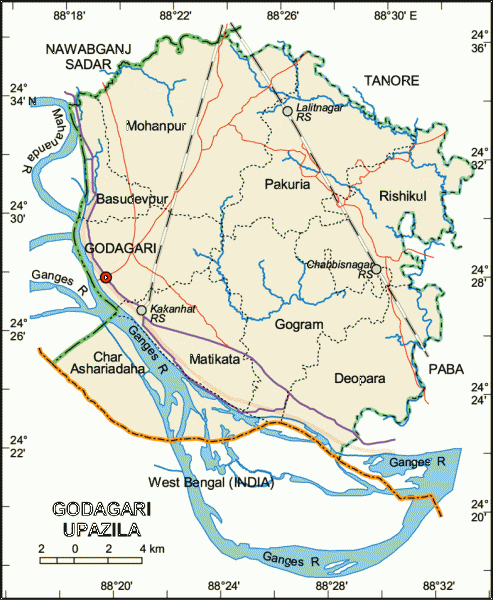
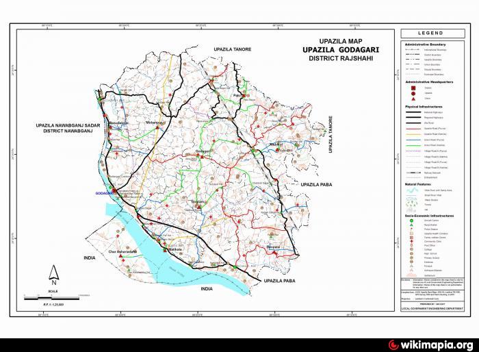
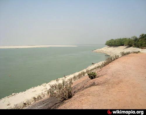
Godagari Upazila (Rajshahi district) with an area of 472.13 sq km, is bounded by Nawabganj sadar and Tanore upazilas on the north, West Bengal of India and the ganges on the south, Paba and Tanore upazilas on the east, Nawabganj Sadar upazila on the west. Main rivers are Ganges and Mahananda.
The location of the Godagari town is 24.4688005N 88.3249014E. Godagari (Town) consists of 9 wards and 18 mahallas. The town has a population of 32210; male 51.69% and female 48.31%. Literacy rate among the town people is 31.8%. The town has a check post and an immigration office.
Godagari thana was established in 1865 and was turned into an upazila in 1984. It consists of nine union parishads, 389 mouzas and 396 villages.
Archaeological heritage and relics: Padumsa Dighi (pond) at village Deopara (eleventh century), tomb of Hazrat Shah Sultan at Sultanganj (fourteenth century), tomb of Ali Kuli Beg at Kumarpur.
As of the 1991 Bangladesh census, Population 217811; male 50.88%, female 49.12%; Muslim 86.55%, Hindu 8.05%, Christian 1.93% and others 3.47%; different ethnic nationals: 3749 families including the Santals.
Religious institutions Mosque 439, temple 18, church 9, sacred place 2.
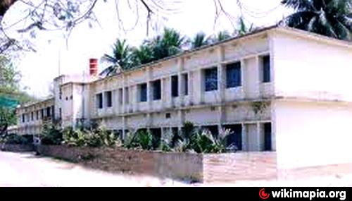
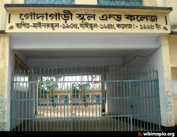
Literacy and educational institutions Average literacy 27.6%; male 32.3% and female 22.6%. Educational institutions: college 11, secondary school 53, madrasa 18, government primary school 76, non-government primary school 63. Noted educational institutions: Godagari Ideal Primary School (1913), Godagari High School (1948).
Main occupations Agriculture 36.36%, agricultural labourer 32.16%, wage labourer 5.35%, commerce 11.25%, service 3.99% and others 10.89%.
Land use Total cultivable land 35750.71 hectares; fallow land 218.74 hectares; single crop 49%, double crop 42% and treble crop 9%; cultivable land under irrigation 47%.
Poultries 9.
Communication facilities Roads: pucca 147 km and mud road 352 km; railways 39.21 km.
Manufactories Rice mill 6, printing press 1, welding 45.
Cottage industries Bamboo and cane work 12, blacksmith 80, potteries 25, wood work 226, tailoring 310.
NGO activities Operationally important NGOs are brac, asa, proshika, caritas, FDSR, IDI, ITCL, Thengamara Mahila Sabuj Sangha, Asia.
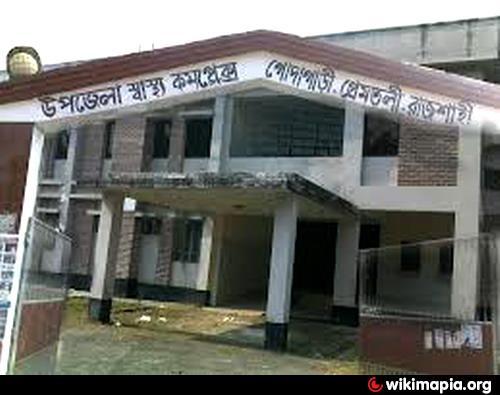
Health centres Upazila health complex 1, family planning centre 9 and satellite clinic 1.
The location of the Godagari town is 24.4688005N 88.3249014E. Godagari (Town) consists of 9 wards and 18 mahallas. The town has a population of 32210; male 51.69% and female 48.31%. Literacy rate among the town people is 31.8%. The town has a check post and an immigration office.
Godagari thana was established in 1865 and was turned into an upazila in 1984. It consists of nine union parishads, 389 mouzas and 396 villages.
Archaeological heritage and relics: Padumsa Dighi (pond) at village Deopara (eleventh century), tomb of Hazrat Shah Sultan at Sultanganj (fourteenth century), tomb of Ali Kuli Beg at Kumarpur.
As of the 1991 Bangladesh census, Population 217811; male 50.88%, female 49.12%; Muslim 86.55%, Hindu 8.05%, Christian 1.93% and others 3.47%; different ethnic nationals: 3749 families including the Santals.
Religious institutions Mosque 439, temple 18, church 9, sacred place 2.
Literacy and educational institutions Average literacy 27.6%; male 32.3% and female 22.6%. Educational institutions: college 11, secondary school 53, madrasa 18, government primary school 76, non-government primary school 63. Noted educational institutions: Godagari Ideal Primary School (1913), Godagari High School (1948).
Main occupations Agriculture 36.36%, agricultural labourer 32.16%, wage labourer 5.35%, commerce 11.25%, service 3.99% and others 10.89%.
Land use Total cultivable land 35750.71 hectares; fallow land 218.74 hectares; single crop 49%, double crop 42% and treble crop 9%; cultivable land under irrigation 47%.
Poultries 9.
Communication facilities Roads: pucca 147 km and mud road 352 km; railways 39.21 km.
Manufactories Rice mill 6, printing press 1, welding 45.
Cottage industries Bamboo and cane work 12, blacksmith 80, potteries 25, wood work 226, tailoring 310.
NGO activities Operationally important NGOs are brac, asa, proshika, caritas, FDSR, IDI, ITCL, Thengamara Mahila Sabuj Sangha, Asia.
Health centres Upazila health complex 1, family planning centre 9 and satellite clinic 1.
Nearby cities:
Coordinates: 24°28'5"N 88°20'21"E
- Bholahat Upazila HQ 57 km
- Gobindaganj Upazila 122 km
- Shaghatta Upazila 144 km
- Sarishabari Upazila 147 km
- Abhaynagar Upazila HQ 188 km
- Fakirhat Upazila HQ 230 km
- Koyra Upzila HQ 250 km
- Kachua Upazila HQ 252 km
- Maidi Vdc 526 km
- Samote Union Council 1756 km
- Confluence of Mahananda and Padma rivers 4.3 km
- Sadhur Mor Godagari Rajshahi 6.9 km
- Renu Camp 8.9 km
- Sabdalpur 10 km
- Krishnapur Rural Hospital 11 km
- Godagari Upazila Health Complex 11 km
- Premtoly 11 km
- Balutungi 12 km
- BAGAN PARA 13 km
- Rajshahi Division 104 km