Ohio Falls Station (Louisville-Jefferson County, Kentucky)
USA /
Indiana /
Clarksville /
Louisville-Jefferson County, Kentucky
World
/ USA
/ Indiana
/ Clarksville
World / United States / Kentucky
dam, hydroelectric power station/plant
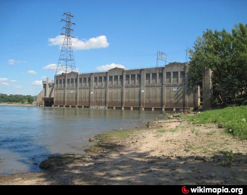
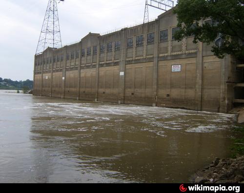
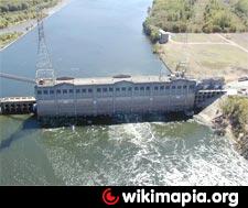
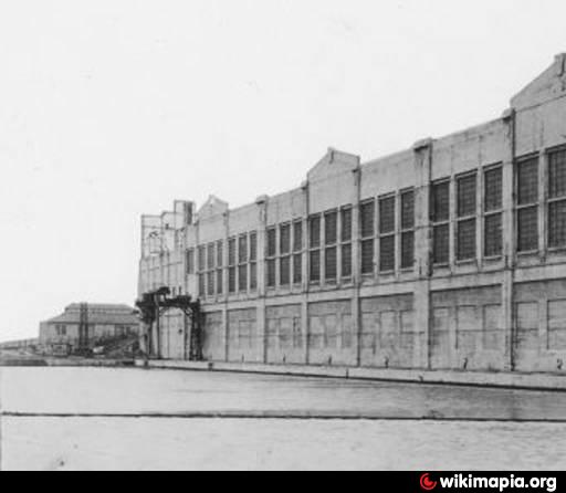
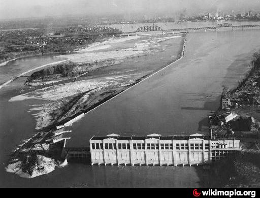
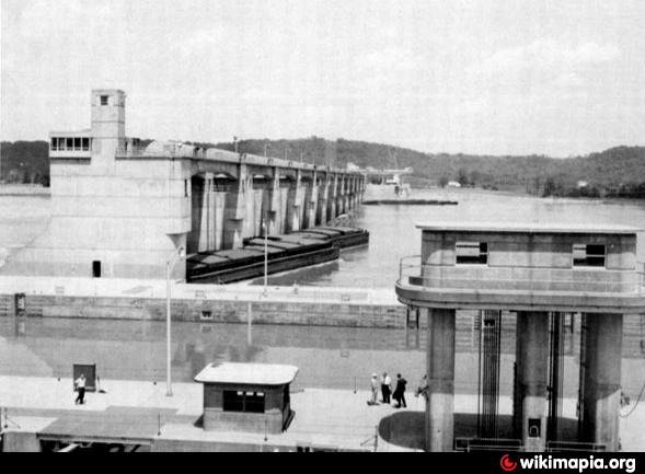
The dam and hydroelectric plant, completed in 1927 at a cost of about $8 million,
created an elevated upper pool and met much of the city's power needs through the 1930s.
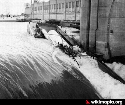
Scene of a chlorine barge accident in 1972.
created an elevated upper pool and met much of the city's power needs through the 1930s.
Scene of a chlorine barge accident in 1972.
Wikipedia article: http://en.wikipedia.org/wiki/Ohio_Falls_Station
Nearby cities:
Coordinates: 38°16'57"N 85°46'53"W
- E.W. Brown Power Generating Station 107 km
- TVA Raccoon Mountain 361 km
- Safe Harbor Dam & Power Station 831 km
- Presa Hidroeléctrica El Chaparral 2729 km
- Hidroeléctrica Ituango 3607 km
- «Macagua» Dam: I, II and III 4061 km
- Caruachi Dam 4066 km
- Guri Hydroelectric Central 4092 km
- Afobaka Dam 4839 km
- Брокопондо 4839 km
- Ohio River Greenway 0.1 km
- Shippingport Island 1.1 km
- Louisville and Portland Canal 1.4 km
- Portland neighborhood 1.9 km
- West End 3.7 km
- Shawnee neighborhood 3.9 km
- Lapping Park 6.3 km
- Floyds Knobs, Indiana 9 km
- Floyd County, Indiana 10 km
- Clark County, Indiana 18 km