Asan Beach
Guam /
Maina /
World
/ Guam
/ Maina
/ Maina
World / Guam
park
Add category
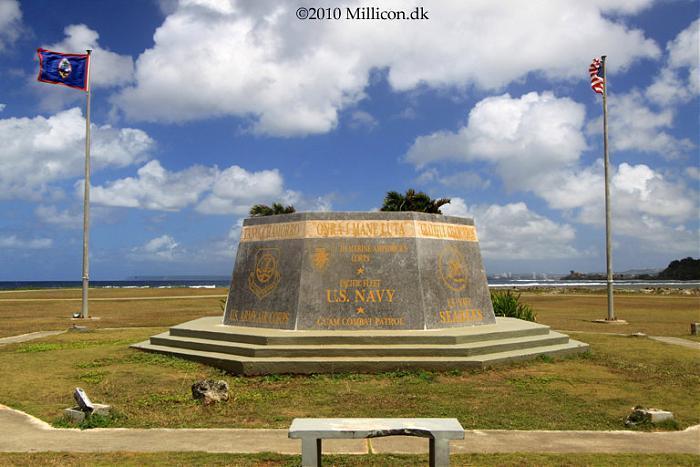
Former site of a leper colony (1892-1900), the Presidio of Asan (1902-1903), a Marine camp (1922-1931), Camp Asan (1945-1947), a civil service camp (1948-1967), a Navy hospital annex (1968-1975), and finally a Vietnamese refugee camp (part of Operation New Life, which relocated South Vietnamese after the fall of Saigon) in 1975. All of the buildings once located here were destroyed by Supertyphoon Pamela in 1976 and subsequently removed. In 1978, the property was acquired by the National Park Service and turned into the War in the Pacific National Historical Park.
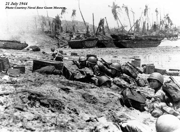
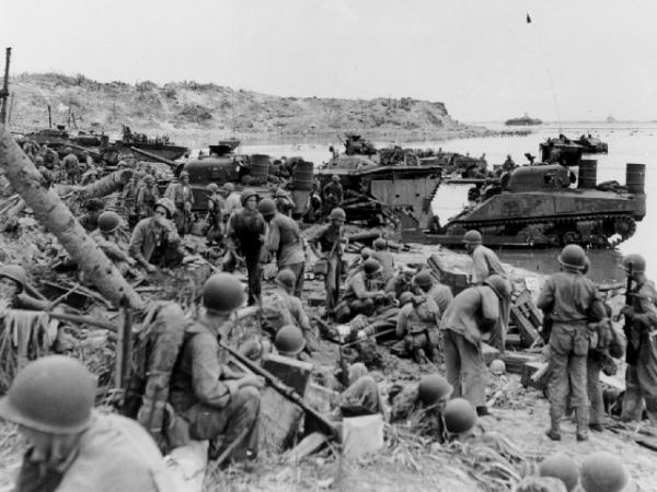
The Asan Beach Unit consists of 109 land acres and 445 water acres and is the site of the northern landing beaches. It was here that the 3rd Marine Division came ashore on July 21, 1944 for the initial assault and was met by troops of the Japanese 320th Independent Infantry Battalion. War-related structures and sites, all associated with Japanese defenses, are located at Asan Point and Adelup Point.
www.nps.gov/archive/wapa/indepth/extContent/wapa/asan_b...
www.nps.gov/wapa/planyourvisit/asan-beach-unit.htm
www.tendertale.com/ttonl/newlife.html
Wikipedia article: http://en.wikipedia.org/wiki/War_in_the_Pacific_National_Historical_Park
Nearby cities:
Coordinates: 13°28'28"N 144°42'38"E
- Fonte Plateau Unit 2.5 km
- Mount Chachao/Mount Tenjo Unit 4.1 km
- Paseo de Susana 4.4 km
- Governor Joseph Flores Beach Park 8.9 km
- Ypao Beach Park 9 km
- Tiyan Field 10 km
- Agat Beach Unit and Ga'an Point 11 km
- Sugar King Park 221 km
- American Memorial Park 223 km
- T'rung Island 841 km
- Asan 0.7 km
- Piti Bay 1.7 km
- Naval Fuel Facilities 3.1 km
- U.S. Naval Hospital Guam 3.2 km
- Polaris Point Submarine Base 5.6 km
- Shell Agat Terminal 6.4 km
- Leo Palace Resort 7.7 km
- Naval Base Guam 8.6 km
- Castella, Guam 9 km
- Guam 9 km