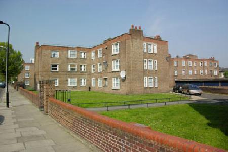
Mapledene Estate (London)
United Kingdom /
England /
London
World
/ United Kingdom
/ England
/ London
World / United Kingdom / England
public housing estate
Add category
The bombing of Hackney was extensive, if largely random. The south of the borough experienced more destruction, as it was nearer to the City and the docks, the main targets of German bombing. The majority of the destruction occurred during late 1940. Then the full force of the German Luftwaffe was deployed to destroy London and other major population centres: to bomb the British into submission.
The destruction of a large section of housing between Mapledene Road occurred on just a few nights in October 1940, when the Blitz was at it height in London. Between the 9th and the 22nd of October, the streetscape changed radically, as photographs and maps reveal. Some houses experienced minor damage; however, at the end of the street, nearest Lansdowne Drive, the housing stock was almost completely destroyed.
Later on in the War, with the development of new weapons, the V1s and V2s, the area was further affected. Lansdowne Drive, just around the corner from Mapledene, received a direct hit, with significant destruction. Please note that the official bomb maps of London do contain errors, and do not detail all the destruction in Hackney, including this. Other sources reveal the full extent of the bombing, especially the effects of later bombing, such as the Official War Diary.
Nearby cities:
Coordinates: 51°32'31"N -0°3'54"E
- Frampton Park Estate 0.8 km
- Gascoyne Estate 1.4 km
- Wenlock Barn Estate 2.1 km
- Clapton Park Estate 2.3 km
- Lansbury estate 3.7 km
- Teviot Estate 4.2 km
- Beaumont Road Estate 4.9 km
- Regents Park Estate 5.6 km
- Elthorn Estate 5.6 km
- Tower Gardens 7 km
- Dalston 0.3 km
- London Borough of Hackney 0.8 km
- Lower Clapton 1.6 km
- Stoke Newington 1.9 km
- Hoxton 1.9 km
- Canonbury 2.1 km
- Islington 2.3 km
- Highbury 2.6 km
- London Borough of Islington 3.1 km
- Tower Hamlets Council 3.7 km
Comments