Land Level Transfer Facility Drydock (Bath, Maine)
USA /
Maine /
Woolwich /
Bath, Maine
World
/ USA
/ Maine
/ Woolwich
World / United States / Maine
shipyard, drydock
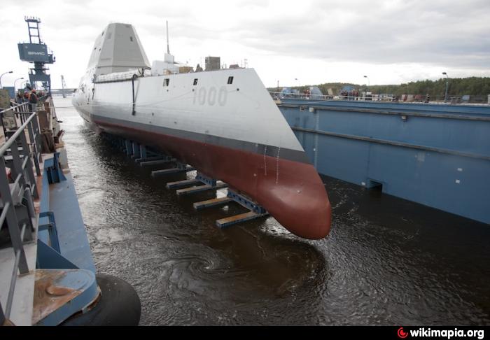
Floating Drydock used for launching ships built on the new LLTF, shown here in place to receive a new ship.
Nearby cities:
Coordinates: 43°54'5"N 69°48'45"W
- Lunenburg 441 km
- Philadelphia Navy Yard (former) 630 km
- Former Site of Sun Shipbuilding & Drydock Company 643 km
- Sparrows Point Terminal (formerly RG Steel/Sparrows Point Steel Mill) 760 km
- Huntington Ingalls Industries Newport News Shipyard 951 km
- Norfolk Naval Shipyard 960 km
- The Royal Dockyard : Rosyth 4738 km
- Goole Dockyards 4962 km
- D.C.N. Lorient 5012 km
- Amwaj 5427 km
- Hanson Bay 2.6 km
- West Bath 4.9 km
- New Meadows River estuary system (Northern section) 5.1 km
- Arrowsic 5.3 km
- Goose Cove/ Kennebec River Estuary 5.5 km
- Woolwich, Maine 7.6 km
- Kennebec Estuary (southern portion) 11 km
- Merrymeeting Bay 13 km
- Topsham, Maine 13 km
- Brunswick, Maine 13 km